Pedal, pedal, pedal, rest. Pedal, pedal, pedal, rest. Pedal, pedal, pedal, rest. Are we there yet?
Such were the thoughts running through my head as I climbed the seven miles up Forest Road 58 to High Rock Summit, about one-quarter of the way into the workers' ride for the Oregon Randonneurs Timothy Lake 200. Neither Lynne nor I would be able to participate in the regularly scheduled ride on July 19, so when the ride organizer, Michael, sent out a call for volunteers, we jumped at the chance to do the workers' ride with him last Sunday. Michael normally rides faster than Lynne and I (MUCH faster) but he had just completed a very tough 1200 K ride a few days before, so we figured maybe we would be able to keep up with him. Famous last words.
There are three things to keep in mind about the Timothy Lake route. One: Michael designed it. Two: Michael likes hills. Three: The route is so spectacular that it is worth whatever temporary pain those hills might cause.
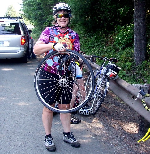
Where was I? Oh, yeah, I was climbing up to High Rock. Michael had advised us that the average grade for that seven mile stretch was 6%. What I had failed to take into account was the meaning of the term "average." What I should have asked for was the RANGE. Which, as it turns out, was 2% to 12%, with an awful lot of it at 7-8%. Hence my resort to my time-tested steep hill strategy of pedal, rest, pedal, rest, pedal, rest, ad infinitum . . .
But I have jumped too far ahead. Let's start from the very beginning (a very good place to start).
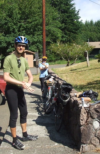
Unlike most of our Or Rando brevets, this one did not start in either Newberg or Forest Grove. Instead, the start is in Estacada, a small town in Clackamas County, on the edge of the Mt. Hood National Forest, about an hour's drive from Portland. This meant that even though we agreed that we would start riding at the very civilized hour of 8:00 AM, I nonetheless had to get up by 5:00 in order to be ready when Lynne came to pick me up at 6:00. Because she was driving in from almost-Beaverton, she had to get up even earlier. We told Michael we would pick him up at his house at about 6:45, so that we would get to the start with a few minutes to spare for traditional pre-ride faffing. For some reason I thought it would take me awhile to load my bike and gear into Lynne's van, and also take a while to drive over to Michael's house. As it was, Lynne arrived at my house a little early, and then she and I were at Michael's by 6:30. So we stood around on the street outside his house until it was time to knock on the door. Lynne drank her coffee (Tea? Something caffeinated in a thermal mug) while I stretched and played with my camera.
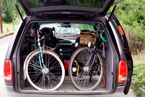
Once we managed to squeeze Michael's bike into the van, we were off. On the way to Estacada, Michael regaled us with stories of the 1200. Apparently it was hot. Very, very hot. The term "knee-busting" was also frequently invoked. Gee, it sounded like fun. Maybe next year, if they run it again. Then again, maybe not.
We arrived at the start point on Faraday Road with plenty of time to spare. After unloading the van, we engaged in a brief discussion about layering; at this point the sky was overcast, and there was the slightest of cool breezes. I was figuring it would clear up and heat up, so had not brought any arm or leg warmers. I had brought long fingered glove and a rain jacket, however, and did don those. Lynne went the full warmer route, but did not put on her wool cap. Michael realized he'd left his gloves at home. I mentioned I had an extra pair, but he pointed out that his hands were about 3 times large than mine . . .
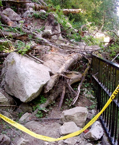
Pre-ride faffing complete, we were on our way. The first five miles of the route are on Faraday Road, which runs along the Clackamas River, and used to be part of state highway 224. A few years back the highway was rerouted over the hill, however, and Faraday now is closed to all motor vehicles except those used by PGE to service its dams. Bicycles and pedestrians are more than welcome however. Very recently, the road was blocked even to cyclists by a very big rockslide, but that has since been repaired. The road is wide, flat, and beautiful.
After five miles, Faraday Road rejoins 224 and the road starts to tilt ever so slightly upwards. It is a very gentle grade, because it is still following the river. We stopped at Promontory Park for a bathroom break. There is a mini-mart there, and in retrospect I should have purchased a few more snacks to pack along. But at the time I figured I was fine - I had two bananas, two PB & banana sandwiches, two Clif bars, some peanuts, and a few "peanut flake" bars from the local Asian market. At the last minute before leaving home I had thought to throw an extra full water bottle into my pannier. That turned out to be a brilliant idea.
From Promontory Park we followed the river for about 20 miles to the Ripplebrook ranger station. There was a little climbing involved, but nothing that would make anyone with more than one gear nervous. We past a number of campgrounds and crossed over the Roaring River, which lives up to its name. We arrived at the station at about 10:00 and verified that there was indeed a little store there. Emphasis on "little." It was minimally stocked with some candy bars, chips, and ramen noodle cups. Camping basics. Water is readily available from a hose bib on the left hand side of the door, however, and there is a standard Forest Service pit toilet. Again, in retrospect I should have purchased a couple of candy bars or bags of chips. The sun was coming out, and we took a few minutes to slather on the sunscreen. Michael paid extra care to slather the lotion on his hands, which are so rarely ungloved.
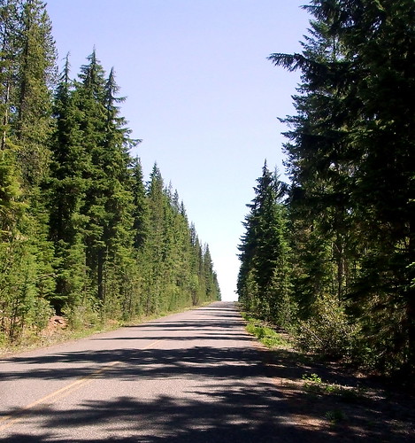
From the Ripplebrook station we continued on for about half a mile to the junction with NFD 57, where we turned left away from the highway and into the woods. Traffic had been light, and now it was almost non-existent. The grade was still pretty gentle for the most part, but every once in while there was a bit of a pitch. It never seemed difficult though, so I was occasionally surprised when I glanced down at my incline indicator to see that it was registering 5 or 6%. Lynne asked if this was "the" climb. Michael responded with an evil laugh, "Noooooo, nooooo, heh heh heh heh . . ."
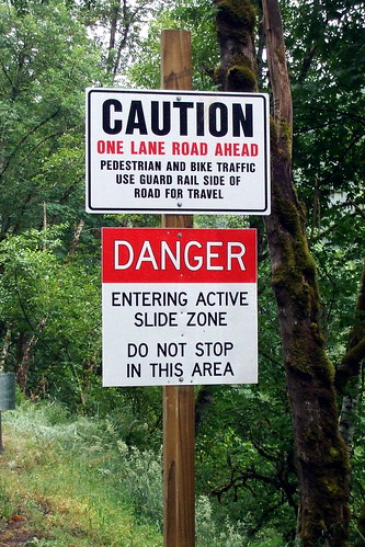
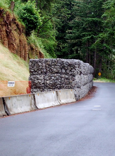
We had assumed that traffic was light because off a landslide that had blocked the road a few years back. The last we'd heard, it had not been cleared for cars to pass through, although it was easy enough to carry a bike around it. But there were SOME cars on the road, and they all seemed to be heading toward the section we'd thought was closed, and none of them seemed to be turning back. Hmmm. Eventually we reached the slide zone, and saw that it had finally been cleared. Dang. We'd been looking forward to having the road to ourselves again.
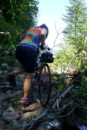
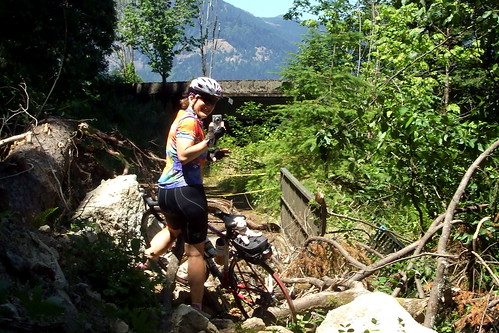
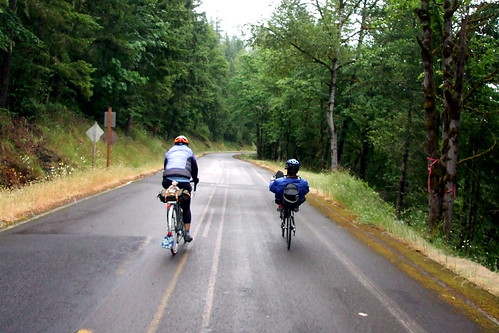
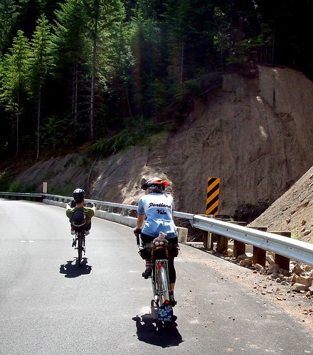
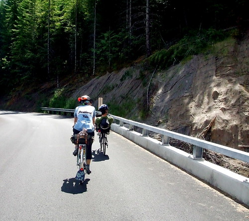
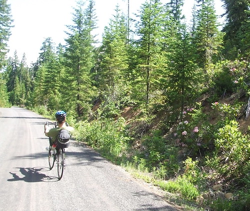
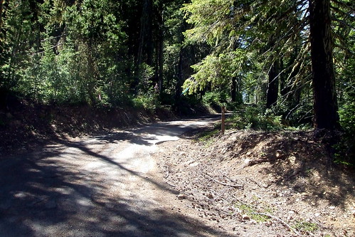
After about seven miles NFD 57 meets up with NFD 58. If we continued straight on NFD 57, we would reach Timothy Lake. We would also be riding uphill, on gravel. We turned onto NFD 58, instead, to begin the climb to High Rock Summit. It was still uphill, but it was paved. Wildflowers were out in force. Lilies, lupine, daisies, columbine, penstemon, trillium, beargrass, ocean spray, and big pink rhodies. I had plenty of opportunity to observe said blooms, because the road had canted fairly steeply up at this point, and I was rolling along very, very slowly. If Michael had not already figured out how much time he was going to be spending stopping and waiting for us to catch up with him, he certainly must have by this point.
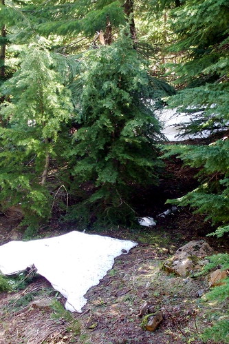
The sky had cleared completely by this point and it was warming up quickly. We were also gaining elevation, and the tree cover was thinning. I stopped and put on some more sunscreen. Up to this point I had been feeling pretty good about the climbing; I had been worried because the previous day I had done a very fast (for me) and hilly 88 mile club ride, and my quads were a little tired. But so far so good. What I had not anticipated, however, was the effect the altitude would soon have on me. My personal combination of anemia and low blood pressure make me particularly susceptible to hypoxia; I feel as weak at 4,000 feet as others might feel at 10,000 feet. High Rock tops out at just under 5,000 feet. That combined with the increasing steepness of the grade brings me back to where this post started -- pedal, pedal, pedal, rest. Pedal, pedal, pedal, rest. Another sign that we were gaining altitude? Snow. Not a lot of it, granted, but snow nonetheless.
Once we reached the top, it was definitely time for a lunch break. I'd already dipped into my food supplies and was out of bananas, but I inhaled a sandwich and two peanut flake bars in quick succession. Michael and Lynne also ate sandwiches and we chatted about the remaining route. Michael assured us that all the evil climbing was "pretty much" over. "Pretty much," we repeated skeptically. "Mostly." Yeah. Right.
The climbing was over for the moment, however. In the next 18 miles we would navigate a few rollers, and a couple of nice descents, to take us down about 1500 feet in elevation to the Historic Clackamas Lake Ranger Station on NFD 42 (aka Oregon Skyline). To me, the ranger station was notable for two things: (1) the visitors' center has an honest-to-gosh flush toilet (a National Forest rarity), and (2) when we arrived, it was the site of a meeting of the Zigzag Hotshots. I immediately flashed back to the summer of my junior year in high school, when I spent a few weeks in the Youth Conservation Corps, dodging rattlesnakes and clearing firebreaks alongside of (and lusting after) the Palomar Hotshots. Ah, youth. But I digress.
The visitors' center is an information control, so we spent a little time deciding what the question should be. Something obvious that can be seen in passing? Something obscure that would require riders to get down on their knees to find? Let's just say we chose something in between those extremes.
A few more snacks, another visit to the toilet (did I mention it flushes?), another sunscreen application, and we were ready to go. Our plan was to follow NFD 42/Oregon Skyline to Peavine Road, and then turn onto Peavine to shortcut to NFD 46. As we pulled out of the ranger station, Michael confessed that he had not ridden this portion of the route before and that in designing it he had relied on information from other riders who had assure him that it was paved and passable. "Here there be monsters," I joked.
It's about five miles from the ranger station to Peavine. Five miles uphill. Easily a match to the climb to High Rock. Two miles shorter, but with a couple of steep pitches. Here there be monsters, indeed.
In addition to some more climbing, it was getting quite warm. Lynne stopped to strip off her leg warmers. Quote: "I'm dying here." Michael pointed out some power lines up ahead, and said that they marked the turn off to Peavine. Boy, they seemed far away. Michael pulled ahead of us, but I knew he would wait for us at the turn.
When I finally reached the intersection, Michael was indeed waiting, but with a rueful look. "I made a mistake," he said. "Uh-oh," I thought, "don't tell me that I just climbed that hill for nothing . . ." "What's up?" "Well, " said Michael, pointing to our right, "that's Peavine, and it's impassable." I looked and saw a potholed, cratered, barely-paved road that rose steeply to a hairpin turn around which I could not see. Oh, dear. I began to regret that whole "Here there be monsters" remark.
As I looked glumly up the road, Michael quickly explained that there might be a solution to our problem that did not involve turning around. He thought we might be able to simply continue straight on NFD 42 until it met up with NFD 46, and then continue on with the route as planned. It would add some distance, because Peavine was the shortcut to NFD 46, but we could cure that by cutting short the out-and-back to Bagby Hot Springs that came later in the ride. In retrospect, it was the best thing that could have happened, because shortly after Peavine we dropped into a descent for the ages. Eight miles of steep, smooth pavement with terrific sightlines and no technical corners. Even Lynne was able to ease up on her brakes for this one! The one caution I would offer is that it is a one-lane road, and there can be traffic coming up hill, so staying to the right is recommended . . .
We were now back down to about 1500 feet in elevation and pretty much done with any intense climbing. From here on out it would be a combination of river grade flats and gentle rollers. I was looking forward to picking up the pace without working so hard.
Cue headwinds . . . .
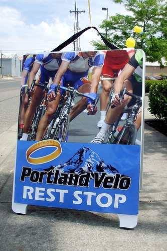
Between the headwind, my altitude issues, my failure to pack enough food, and fatigue from the previous day's Portland Velo speed-fest, I was really beginning to struggle. By my calculations, we would not make it back to the Ripplebrook ranger station before its little store closed. Fortunately for me, Lynne had packed more than enough food and gave me a peanut butter granola bar from her stash. I a always happy when she comes on rides with me, but I was especially happy this time.
NFD 46 is the Clackamas River Road. It follows the river downstream and eventually turns into Highway 224, which we would follow back to the start. But first there was the matter of the out-and-back. Originally, the plan had been to turn off NFD 46 into NFD 63, the Collawash River Road. We would follow that to NFD 70, which is the turn-off to Bagby Hot Springs, and take NFD 70 all the way to the hot springs' parking lot. Because we'd added mileage by re-routing away from Peavine, we figured we only needed to go as far as the NFD 63/70 intersection before we turned back.
NFD 63 starts off with a very brief climb ("I don't remember this," said Michael), crosses over the Collawash River ("Okay, I remember this," said Michael), and then runs along the Collawash. Of all the roads we'd been on so far that day, this one had the worst pavement. It was not bad pavement; it just was not as good as we'd so far enjoyed. There were a lot of potholes, some fairly deep, that appeared to be caused by rocks falling from the steep cliffs to our right (heading out - to our left heading back in, of course). Each pothole was nicely outlined in orange, however, so they were easy to spot from a distance. Reaching the Bagby turn-off, we figured out an information control question and turned back for the home stretch.
By this point I was REALLY hungry. Starving. My stomach was singing little songs to me.
To make matters worse, all the water I had been drinking was making its presence known. By my calculations, we were less than 10 miles from Ripplebrook ranger station. The "store" would be closed, but the toilet would be open. That would take care of one problem, at least. Michael warned me that we would first have to tame a couple of pernicious rollers before we got to Ripplebrook; for once I think he overstated the case. Either that, or I was so anxious to get to the station that I was simply impervious to any more pain.
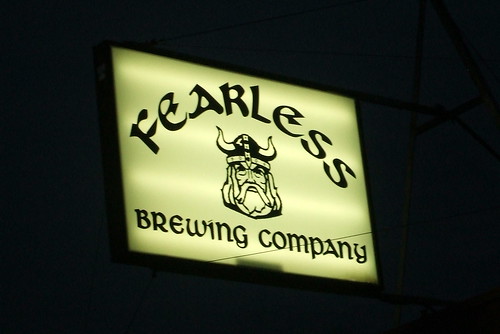
Back at Ripplebrook I made the necessary pit stop, slathered on a tad bit more sunscreen and girded up for the last leg. We were about 25 miles from where we parked the van, but had concluded that we needed to continue on into Estacada to make up some mileage. Michael suggested that we change the route's start/finish to the brewpub in town, to ensure that riders got the full benefit of 200 kilometers and to ensure that Michael got the benefit of beer while he waited to check riders in at the end.
From Ripplebrook to the end it is mostly downhill. Mostly. We were still being tormented by the headwind, however, and my calorie-deficit was taking its toll. What psychic energy I still had, I was focusing on the market at Promontory Park. "Please still be open. Please, please, please, still be open." I watched the mile markers slip away (slowly) and listened to my stomach rumble (loudly). Finally the turn off to the store hove into view. A short downhill into the parking lot and there it was. Michael was standing on the porch, a chocolate milk in his hand. Lynne and I hurried in and snagged the last two chocolate milks, a bag of Smart Food and a Rice Krispie treat. We sat on the steps, ate our snacks and discussed the next stage. We considered riding into Estacada and getting dinner at the brewpub before coming back for the van, but realized that we didn't have any bike locks. My snack had quieted my stomach's complaints for the time being, so we decided to ride into town, check the distance, come back for the van, and then go back for dinner and beer. Mmm, beer.
After a return trip down lovely Faraday Road to the van, we double-checked our mileage. Yup, we'd definitely have to change the start/finish to the brewpub. So into Estacada we went. On the way out the gate, Lynne noticed that it would close automatically at dusk. Another good reason to make the change. Some of the slower riders might get locked in for the night, otherwise.
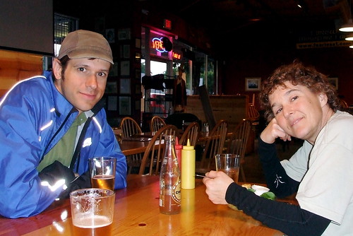
We were all ready to be done at this point, so we rode quickly into town, stopped at the brewpub and noted the time and distance on our cards, and then rode just as quickly back and shoved the bikes into the van. Lynne had thought to bring a set of "apres ride" clothes, so she changed in the van while Michael and I called our respective homes to report our whereabouts (note: the parking lot may be the last place on the ride where you will have cell phone coverage). Then it was back to the brewpub, where just about everything on the menu is deep fried, except the beer. Yum.
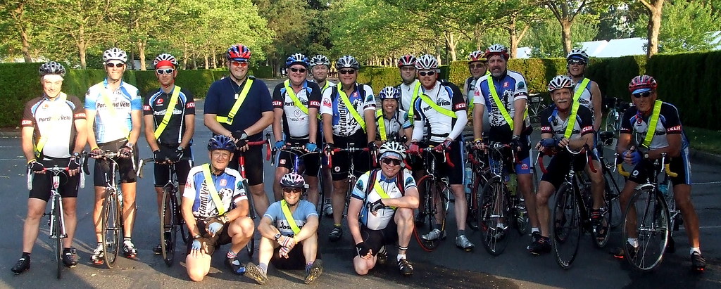
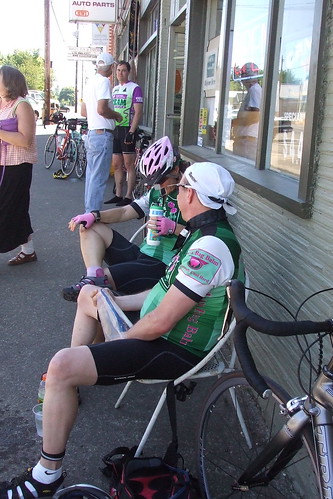
This meant that we would ride the same course as the Challenge participants but we would carry tools, extra inner tubes, and extra water in order to be able to assist anyone who needed help. We would also be making sure that riders rode safely, took off their headphones and obeyed traffic laws. At least we would ask them to ride safely, obey the traffic laws and take out their headphones -- sadly I was not allowed to arrest an iPod-people, as much as I wanted to. In addition to providing course marshals, PV would be running the final rest stop of the day.
In order to add some pizazz to our duty, the club volunteer coordinators came up with a "Top Gun" theme. We were divided up into "squadrons" based on the route we had chosen and our average pace. Lynne, Jason and I rode together (surprise!) as "Iota Squadron." We would be toward the end of the 70-mile group. In addition to our squadron names, we were each assigned a call name. Lynne was "Betty," Jason was "Tomcat," and I was "Chipper." They told me it was a reference to my cheery disposition, but I knew better.
The ride started at Nike World HQ in Beaverton - about 15 miles from my house in SE Portland. Lynne's house was on the way, so once again we arranged to meet there for the ride in to the start. Our friend Beth was signed up for the 70-mile course, and she spent Saturday night at Lynne's in order to ride in with us. We had to be at Nike by 6:45, and we would first be stopping by Jason's house to fetch him, so I told Lynne to expect me at her house at 5:50. That meant leaving MY house at 4:50. Joy. I had done a long, hot ride on Saturday, and then was not able to sleep much because of the heat, so when my alarm went off at 4:00 I was less than enthused about getting up . . .but get up I did, and after a cool shower I felt much better. I got myself together, saddled up and went over the hill to Lynne's house.
Because we would need to be carrying a lot of extra cargo, I rode Lil' Hw Jr., Lynne rode Bleriot and Jason rode his Sekine. We figured we would have the heaviest bikes in the field. We would also probably be the most comfortable riders in the field. In my pannier I packed a bunch of extra inner tubes in a few sizes, some patch kits, a multi-tool, baby powder, chamois cream and a small first aid kit. Later on I would add a few filled water bottles.
Just like last year, we spent almost an hour hanging around the parking lot waiting for the ride to start. Although they had tried to group the different course riders separately, so as to allow for staggered starts, everyone got a little too eager and lemminged up to the front, causing a fair bit of kerfuffle. We got stuck in with a lot of 40-mile course riders and so had to do some tricky maneuvering (and a little cross-country riding) to get back with the 70-mile riders. As a result, we were the tail end of the 70-mile group.
It was not nearly as hot as it had been the day before, and we had a slight tailwind. Even though we were pretty loaded down, Jason and I were setting a pretty brisk pace. Mainly because I couldn't control myself and because Jason was feeling competitive. After dropping Lynne a few too many times, we slowed down and rode at a more sensible pace. Lynne wanted to know if we planned on riding like super-heroes much longer and pointed out that we still had a long day ahead of us. Point taken.
The LiveStrong Challenge is notable for two things (at least as far as I am concerned). One, it is IMPOSSIBLE to get lost on the course (at least I thought it was - more about that later) because every turn is marked with very large yellow signs and almost every turn has a volunteer standing at it telling the riders where to go. Two, there is a rest stop every 10 miles. We stopped at the first one, skipped the second one, and stopped at all the rest. We stayed at the last stop for over an hour (again, more on that later). In other words, we spent as much time at rest stops as we did riding.
The 70-mile course was almost the same as last year - from Beaverton we rode out through Hillsboro and Forest Grove to Hagg Lake, around Hagg Lake, back through the outskirts of Hillsboro to North Plains and then back to Beaverton. The only difference was that this year we went around Hagg Lake counter-clockwise, so as to avoid having riders turning left in front of other riders speeding down the hills. This meant, of course, that we started off the Hagg Lake section with a steep climb.
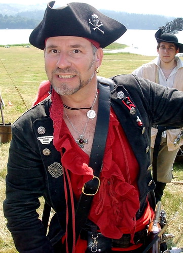
Halfway around Hagg Lake was another rest stop. It had pirates. Last year it had hot soup. This year there was no need for that.
Up to this point, we hadn't really done much "marshaling." We'd told a few folks to "single up" so cars could get past, and I'd told one rider to take out his headphones. He ignored me. He probably couldn't hear me. But on the back side of Hagg Lake we had our first "real" test. A woman had stopped by the side of the road, and was looking quizzically at her tire. Jason stopped to talk to her, and as I rolled up she was showing him a very interesting lump about 1.5 inches long that had developed on her tire. It didn't look good. We decided surgery was required and removed her wheel.
After deflating and removing the inner tube from the tire, I started to run my fingers along the inside of her tire where the lump had been. "Hmm, that feels interesting. Hey, look! Her tire is totally falling apart!" I turned the tire inside out so she could see where the rubber was delaminating from the casing. Needless to say, she was not happy. While we were working on her bike, a Sag Vehicle slowed down to see if we were okay. "Do you have a tire in there?" Nope-they were medical support. They had Power Bars, if we wanted those. Nah. The driver radioed in for a "mechanical" Sag; it would come in about 15 minutes, he said. So we sat down to wait. We figured it wouldn't be cool to leave her to sit all by her lonesome.
About 15 or 20 minutes later, the van appeared. As they loaded her bike on top, we said good-bye and headed out on our way. Just after we left the lake, we came upon our next distressed rider. A man and his wife were standing by the side of the road; she had a flat tire. I could tell just by looking at them as we rode up that they had never changed a flat before. They had no extra tubes, patch kit or tire irons, but strangely enough they did have a CO2 tire inflator. It had been used, and was lying on the ground next to the bike. I am pretty sure they tried to just re-inflate the tire after it went flat. I am also pretty sure that one reason it did not work was the GIANT staple that I pulled out of her tire and tube. While we were helping her, the SRAM support car drove up. I was being particularly inept trying to reinstall new tube and tire, so gladly turned that task over to the mechanic. And we were off once again.
And now, remember how I mentioned a bit earlier that it was IMPOSSIBLE to get lost on this ride? Well, almost. About 5 minutes later, as Lynne, Jason and I slowed to make the next turn, we watched in amazement as a hammerhead passed us and blew right past the turn. The EXTREMELY WELL- MARKED turn. BIG yellow signs and everything. Jason yelled after him "Hey! Do you WANT to be off course?" No response. "Hey! HEY! YOU MISSED THE TURN!" Oh crap. The way the roads go out in that neck of the woods, it could take him miles to figure out what he did wrong. Good thing I'd been reserving some energy, because it was time to sprint. I chased him for about 1/2 a mile. Yelling the whole time. When I finally caught him, I saw why he hadn't heard us. He had on GIANT headphones, and when he pulled them off to find out what I wanted, I could hear heavy metal blasting out. I should have let him get lost. As it was, I gently explained that he had missed the turn, and guided him back. He asked if I was an "official" rider, and I said I was a ride marshal. "What do ride marshals do?" "Oh, you know, help people with flat tires, chase down lost people, TELL THEM NOT TO WEAR HEADPHONES." He so totally did not get it.
Back at the Fern Hill rest stop, we met up with our friend Beth. She was on her way back from Hagg Lake, but was in a lot of pain from an old knee injury. She was determined not to sag, however; and was on her way to get some Bio_Freeze from the medic. I later learned that she ended up having to sag after all, because of heat exhaustion. But she'd at least gotten to Hagg Lake, which was something she had really wanted to accomplish.
In addition to being course marshals, the three of us had volunteered to be "wingmen" ("wingpersons"?). This meant that we would hang out at the final rest stop until all riders had passed the second-to-last rest stop. We would then slowly ride the remaining 10 or so miles with those last rider, to make sure everyone got in okay. The final rest stop also happened to be the one staffed by Portland Velo members, and the club had gone all out to make it the best stop of the day.
There was a garden house for overheated riders to get a quick cool-down, and a kiddie pool filled with ice in which to soak our hot and swollen feet.
We spent at least an hour at the stop, cooling off, chatting with other marshals, and listening to the hilarious Portland Pep Band (big band versions of heavy metal songs). Finally it was time to head out for the last stretch. While we were waiting, however, storm clouds had started to roll in. As I looked toward the West Hills, which I would have to go over to get home, I could see that in some places it was already raining. At this point we were on West Union Road. If I kept going straight, I would be able to get home in less than an hour and a half. If I continued on to the end of the Livestrong course, I knew that it could be much longer than that before I finally made it home. By now, almost all the riders had completed the course, so I knew that I would not be needed for any further marshaling duties. I decided that I should just go home, and told Lynne and Jason that I would be doing so. I gave Lynne my reflective Sam Brown belt (I really wanted to keep it for brevets, but it was not mine to keep) and waved good-bye to them at the turn.
And then it was deja-vu all over again; I was climbing the same hill that I had climbed less than 24 hours earlier. This time it was much cooler however; it was only about 90 degrees, maybe even cooler than that. There were a couple of points near the top of the hill where I felt some rain drops, but it never came to anything. I sped down the hill and through NW Portland toward home. As I entered my neighborhood, I felt the first real drops of rain. Big, fat, heavy drops - the kind you can almost ride in between. I was less than two minutes from home - could I make it without getting wet? I was sheltered by trees until I got to the alley that runs behind my house, and so it was only the last stretch down the alley that I worried about. I turned into the alley, poured it on, and got to my garden gate just as the clouds burst. Exquisite timing on both our parts.
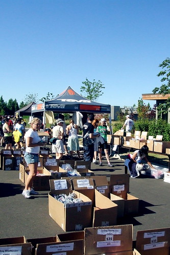
Ahem, that's TEAM Bag Balm and TEAM Estrogen. TBB is a very loosely organized riding group to which I belong, and TE is an internet vendor of women's cycling, swimming and running gear that is owned and operated by a fellow TBB member. On Saturday, June 28, there was a rare confluence of the two, when TE held a parking lot sale and barbecue at its World Headquarters in Hillsboro and a few of us decided to combine some shopping with a group ride. Our friend Don sent out the call, and after a few e-mails back and forth to coordinate times and distances (did I mention that we were LOOSELY organized?), the plan was in place. We would meet at TE at 9:00 AM, browse the sale racks for a bit and then roll out by 9:30 for a 40 or 50 mile ramble before heading back to TE for some more shopping and lunch.
As usual, I rode out to Lynne's and we rode together to the start. A heat wave had started two days earlier, and Saturday was forecast to be the hottest day of the week, with temperatures predicted to rise to over 100 degrees. When I left home at 7:00 AM, it was already over 70 degrees and the sun was very bright. Because I was riding with TBB for the first time in a long time, I decided to haul out my TBB jersey, even though it is a little less "breathable" than some (it makes up for that in pure style - it gets more "Cool jersey!" comments than any of my others).
Because I needed to get up and over the hills between my house and Lynne's quickly, and because I wanted to cut down as much as possible on my cargo-carrying capacity so as not to go nuts at the sale, I rode the Bianchi - my "fast" bike. Fast being a relative term, of course. Between that and a tail wind that helped propel me up the hill through Washington Park, I arrived at Lynne's house 10 minutes early. She was almost ready, and I took advantage of the time to use her bathroom. I knew she would understand.
Lynne was on her fast bike, too, and she was also flying the TBB colors.
She had also cut down on cargo-carrying capacity, but only because she was counting on her husband, Fitz, coming by the sale later in the car to carry home her purchases. She reminded me that I could have him do the same for me . . .
On the way over to TE, we rode by Jason's house where he was outside waiting for us. He too, was representing TBB. We had ourselves a herdlet. We wove our way through some parks and side streets, with a brief period on busier streets like Evergreen and Cornelius Pass Road (we took the sidewalk on CP - it's just too scary), and arrived at TE shortly after 9:00. The sale was well in progress, and we quickly spotted our friends Don, Laura and Diane in their herd gear. Our friend Linda was there, too, but she was traveling incognito in a possibly more sensible sleeveless red number.
Although the plan had been to roll out no later than 9:30, it was difficult to tear ourselves away from the bargains. And my carefully thought out plan of forced frugality was dashed when my friend Slug, whose wife Edna works at TE and who was helping out at the sale, mentioned that he could drop any packages off at my house for me on his way home. Thus, by the time we finally rolled out, I had picked up a new pair of summer gloves and a completely frivolous hoodie. I knew that I would probably add to the pile after the ride - they had an enormous selection of Smartwool socks on sale and I can always use more socks. But the temperature was rising and the riders were getting restless. On the way out, I ran into the fabulous Natalie and Austin from Sweetpea; Natalie had a feeling we'd run into each other at the sale and she'd brought me the extra key for the Pitlock on my generator hub (they'd had to order it from Germany). I passed the box off to Slug, apologized to N & A for not being able to chat, and hurried to catch up with the herd. It was about 9:45, so we weren't TOO far off schedule. Especially by TBB standards, which must always be adjusted for faffing times.
The plan was to do a route that included two different "out and back" components - Dairy Creek and Pumpkin Ridge. After some discussion, we decided to go out to Dairy Creek first, because on the way back from Dairy Creek and over to Pumpkin Ridge we would pass a water source. The temperature was already into the 90s at this point, and hydration was a key consideration.
Our little group quickly separated as the speed demons Don, Jason and Linda bolted ahead. Laura and I were setting a fairly brisk pace ourselves, but I could not keep up with her for long. Diane and Lynne were not far behind, and had caught up with me and Laura by the time we reached the 4-way stop outside of North Plains. There we decided to turn right to go up to North Avenue to cut through town, instead of staying on the main drag, because the pavement was smoother and there was rumor of a blue room at the school on that street.
There was no blue room at the school, but there was one at a nearby construction site. We spent a little time taking care of business and then continued on our way. We were in no hurry-we figured the speedsters had already zipped through town and were well on their way to Mountaindale, and maybe we'd catch up with them there. Suddenly Lynne's back pocket started singing. It was her cellphone. Jason was calling. They were sitting out in front of the market on the main street of North Plains and were wondering where in the heck we were. Whoops. So we stopped at the intersection of North and Gordon and waited for them to catch up. They caught up, and then quickly outdistanced us again. Oh well.
I really like the ride out to Dairy Creek. It's relatively flat until you get to the turn off onto Dairy Creek Road itself and none of the roads are heavily traveled. Once you are on Dairy Creek, the road takes just the slightest of inclines - no more than 2% at any time. Just enough to make you wonder if you have a flat tire or rubbing brakes, because you shouldn't be going so slowly on what LOOKS like a flat road.
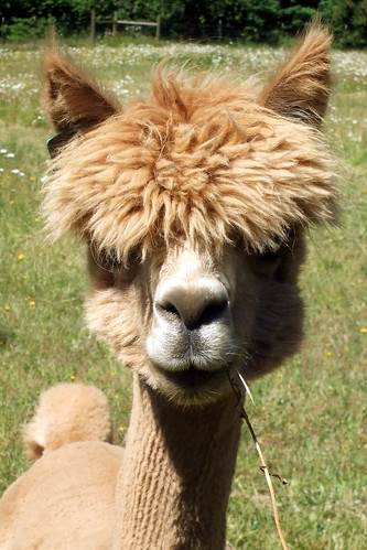
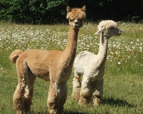
It was QUITE warm at this point and Lynne and I were ambling along at a sensible pace. In other words, we were well behind the rest of the pack. I slowed us down even more when I spied some adorable alpacas with poodle cuts in a field to our left. (At the time I identified them as llamas - I do know the difference, but sometimes still mix them up). Anyway, I felt obliged to stop and talk to them.
As soon as I pulled my bike over to the fence surrounding their pasture, three alpacas came running over. I think they thought I might have some sort of tasty alpaca treat for them. Sadly, all that I had was a camera. I wasted a significant amount of time getting extreme close-ups.
Lynne finally pried me away from my Peruvian pals and we rode on to meet the rest of the gang at the end of the road, where they were taking advantage of the shade to rest, re-hydrate, and apply sunscreen. At this point it was close to 11:00 and really hot and none of us seemed to be in any hurry to get back on our bikes. But we were less than 1/3 of the way into our planned route, and after some discussion Lynne, Jason, Don and I decided to head back for TE from there and skip the rest of the ride. Linda, Laura and Diane rode back with us as far as North Plains. After some more time hanging out in the shade at the North Plains market, downing sport drinks and eating salty snacks, we split up, with the four of us heading back to TE and the other three off to tackle Pumpkin Ridge.
We rolled back into the TE lot at about noon. Jeff had fired up the grill, and called out to us "beef or veggie?" "Veggie, please." "Cheese?" "Oh, yes, definitely." In addition to the burgers, there were coolers filled with ice cold water and pop. Aah, now that's how to have a parking lot sale.
One Boca burger and two ice cold Diet Cokes later, I was ready to do a little more shopping before heading for home. Over the next half hour I collected a new pair of running shorts (uh-oh, that's not a good sign), a NON-frivolous hoodie, and a whole lot of socks. I handed the bag off to Slug, refilled my water bottles, said goodbye to the gang and rolled out for the last leg of the day. TE is just off West Union Road, which if you follow it long enough turns into Thompson Road which goes up and over the West Hills into town. It's one of the easier ways back over the hill - about 4 miles at a 4% grade. Not bad, given some of the alternatives.
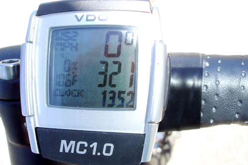
At this point it was astonishingly hot. Throughout the day as we were riding I had watched as the temperature gauge on my cyclometer ticked up, each time thinking, "Okay, that's it, that's as hot as it can't get." Each time it got hotter, until by the time I was about to start the steepest climb of the day, it was showing 106 degrees.
In my experience, accounting for radiant heat that it picks up from the road this particular cyclometer has a margin of error of less than 4 degrees, so I figured that it was really only about 102 degrees. Not that that really made a difference. I bailed down to my lowest gear and spun my way up the hill. 31 minutes later and 700-plus feet higher, the air temperature had fallen six degrees. Not that I could tell. But I was about to take advantage of the "poor man's air conditioner" - nothing like a steep decent at high speed to cool oneself down after a hard climb. One more long drink of water (very HOT water by this point), and I pointed myself down the hill and toward home. 20 minutes later I was home. 22 minutes later I was standing in a cold shower, tasting the salt and sunscreen as it rolled off my face and down the drain.
All told, I did 73 miles with an average speed of 14 mph. Not bad considering the heat and the climbing. The rest of my pictures are here. Lynne' pictures are here.


