As we stood outside the Thriftway at 7:30 PM, I turned to Lynne and I said, "Boy, it's nice to finally have done ride in which the most 'epic' moment was a kilometer of loose gravel." She readily agreed. We had just finished the "Two Ferries" permanent, a 200 kilometer ramble through the Willamette Valley, thus cementing Lynne's "October 200" for her R-12. I had gotten my October 200 in the previous week, on the Bingen Bikenfest, but Lynne had been unable to complete that ride and so needed a mulligan
But that was the end of the ride; let us now return to the beginning. The ride really began the night of the 4th, as Lynne and I drove home from Bingen. The good thing about having attempted to get the October 200 in so early in the month is that it left us with three more weekends in which to try again if either of us had been unable to finish. So now we began to discuss when we would do a make-up ride. It would have to be a permanent, because there were no 200K brevets scheduled. Lynne's travel schedule for work also created some difficulties, as did my volunteer schedule, but we concluded that we were both available Sunday the 12th. So Sunday it would be, rain or shine. We were praying for "shine."
But what route should we do? There were a number of considerations. For an R-12, you can ride the same routes over and over again, but I am shooting for a distance award as well (5000 kilometers) and for that you cannot repeat a route in a calendar year. There are a number of routes that I haven't done, but most of them are either quite far from our homes, or involve significant elevation gains, neither of which we really wanted to do after Bingen. This late in the year I prefer the flat, low elevation perms. That meant it needed to be something in the Willamette Valley. The only two valley perms that I have not done this year were the "Prairies and Wetlands" and "Two Ferries." Of the two, "Prairies and Wetlands" had the least amount of climbing, and so I was hoping to reserve it for November or December, when bad weather was more likely. The cue sheet for the Two Ferries route suggested an elevation gain of 6000 feet, but I knew that HAD to be wrong, because I had been on almost all those roads before at one time or another, and there simply was no way to get in that much climbing in the Willamette Valley in only 200 kilometers. I guessed it was more likely to be in the 3900 foot range (and my altimeter bore this out - at the end of the ride it showed a total gain of only 3745 feet). So, the Two Ferries it would be.
The next step was to convince our RBA, Susan, to let us do a permanent on such short notice. She prefers to have all the paperwork (this is a French sport, of COURSE there is paperwork) submitted at least a week ahead of time. So I sent a begging e-mail, and followed it up with a whining telephone message, and she relented. I am guessing it did not hurt that Lynne and I are regular volunteers for the season's brevets. We sent in our waivers and fee, got the password for the all-important brevet card and we were good to go.
For the next few days, we were glued to the weather reports - there had been rain earlier in the week, but the trend appeared to be toward sun. The report I saw on Saturday night showed no signs of rain, and high temperatures in the mid-60s. Lynne was taking no chances, however; her packing list resembled something Scott might have taken on his ill-fated expedition. She explained that she would just take everything in the van, and decide what to actually wear at the last minute.
We decided to start at 7:00 AM for maximum daylight. Because the route begins in Newberg and because I would need at least a half-hour of quality faffing time once I got to the start, that meant leaving home by 5:30. Which meant getting up by 4:30. At 4:30, it was raining at my house. Damn. What had I done with those rain booties from last week? Of course, by the time I reached Newberg, the rain had stopped. I wasn't taking any chances, though; I stuck the booties and my rain mitts in my pannier, along with extra gloves and my new Showers Pass hood
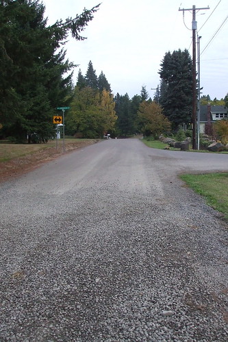
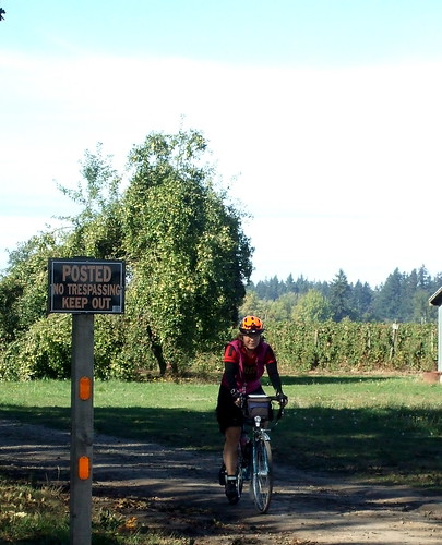
We left Newberg heading northeast toward Sherwood on Highway 99W. I despise this highway. The shoulders are debris-filled and the drivers are insane. I was thrilled to get off it, but the thrill quickly turned to dismay when I realized that the gravel road on which we were turning was very fresh, loose, wet gravel. I could not see the end, and checked the cue sheet, which advised that the gravel stretch was about 1 kilometer long. Sigh. Oh well, I thought, I'll ride as far as I can before I get off and walk. Crunch, crunch, crunch - yikes, a downhill - I don't want to brake, I'll slide out!
Crunch, crunch, crunch - Yikes, another downhill - steady, steady - hey, is that PAVEMENT up ahead? Yes, yes, it is pavement.! Whoo-hoo . . . .
Having survived the gravel test, we wound our way through Sherwood. The cue sheet was less than helpful here, because it had the wrong street names and had not been updated to reflect some massive reworking of the street grid in Old Sherwood. Fortunately, I had the presence of mind to check out the route on g-maps the day before, and knew where to go. Mostly. We still had to ask a passerby of we were actually on Oregon Street. Yes. Okay then. On the bright side, I did finally find a street that I had been unable to locate on a pre-ride last year and decided did not exist. Turns out the street did exist after all; just nowhere near where our cue sheet for that ride had us turning on it.
After Sherwood we passed quickly through Tualatin, across the freeway, up the hill past the hospital and through the new (very new!) roundabout at Wankers Corner (fill in off-color joke here). The roundabout was so new that the bike lane markers were still only stencils.
Traffic on Borland Road was terrible; dozens of megasized SUVs headed for the megachurch between Wankers' Corner and West Linn. Whatever Christian charity those Lexus drivers had, they were not showing it to cyclists. The church had a parking lot as big as the ones at Wal-Mart, and Lynne pointed out that the lot's "streets" were named after books of the Bible.
"Honey, do you remember where you parked the car?"
"Um, I'm not sure, it was either Leviticus or Judges."
I wondered if there were ever fights over who got to park in John 3:16.
It started raining shortly after we passed the church. Not hard enough for us to stop and make clothing adjustments, but enough to make me at least ponder making clothing adjustments. It was less than three miles to our control in West Linn, however, and I decided to just keep riding and make the adjustments there. West Linn was an "open" control, but the only places open were a bar and a coffee shop. We went to the coffee shop, where I had a delightful oatmeal cookie and spent way to much time in the bathroom. Lynne was about to launch a search expedition . . .
We finally pulled out of West Linn and backtracked on Borland to tackle the first climb of the day - a steep trip up Turner Road to Mountain Road, which we would then take around the flank of Pete's Mountain to get to the Canby Ferry.
I was happy to be heading east on the ferry, because the climb up from the river on the other side is not so bad. Heading west, the climb is a steep switchback that tops out at about a 15% grade. I don't walk it, but I've come close. As we sped DOWN that hill to the ferry landing, we crossed paths with riders taking part in the Harvest Century, a supported ride that started in Champoeg Park. We called out encouragement as they struggled up the hill, and yelled slightly less encouraging comments at the ones that weren't watching where they were going as they tried to tack up the hill, directly into our path. Sigh.
The ferry was just pulling away from the shore as we reached the landing, so we pulled over to the waiting area to hang out. On the far shore we could see a herd of lemmings, I mean cyclists, waiting to board. The line stretched all the way up the hill and out of view. The ferry docked and the riders packed themselves on like sardines for the westward voyage.

Finally, it was our turn. We rolled on board, making sure to gear down for the climb up the other side. On the other side it was pandemonium. Well, maybe not THAT bad, but there were cyclists everywhere, paying no heed to oncoming traffic. The line was very long. But at least they had pretty flowers to look at.
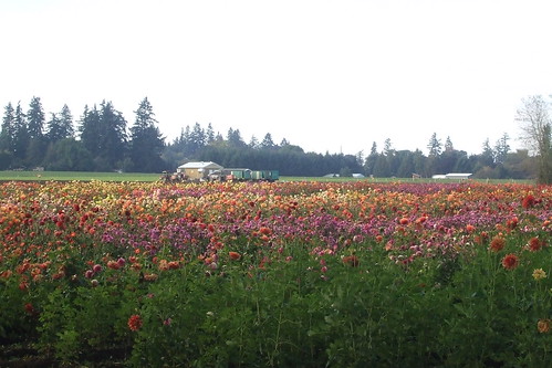
As we rode into Canby, past fields of dahlias and pumpkins, we saw our friend and fellow randonneur, Sal. We called out to him to turn around and join us, he'd have more fun. He just smiled and kept going. Shortly thereafter, we started to notice a number of riders from the Harvest Century passing us on their way back to Champoeg. I was curious; I had not remembered there being any route option on that ride shorter than 75 miles, and these people could not have done more than 30. I later learned that the wait for the ferry was as long as 90 minutes at that point and a number of riders just gave up. I bet Sal WOULD have had more fun if he'd joined us.
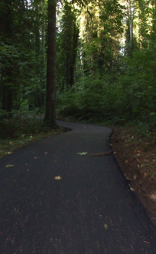
From Canby, we headed southwest toward Salem, by way of Butteville and Champoeg Park. The route took us onto the Champoeg Bicycle trail, which I had never ridden on. It had just been repaved and was a perfectly lovely ride.
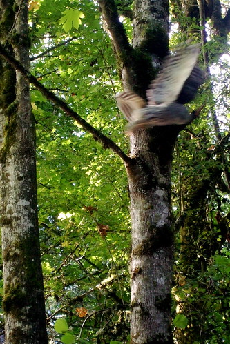
At one point we came across a mother and daughter who had stopped on the trail. As we started to pass, the mother pointed to the trees and said, "Owl!" We looked, and there was a large Barred Owl perched on a branch just above the trail. Lynne and I whipped out our cameras, but it flew away before I could get a good picture. Instead I got a "See that blurry thing there? That's an owl!" picture.
By this time we were running late. The climb up Pete's Mountain and my extended stay in the bathroom in West Linn meant that we needed to start pushing harder if we were going to get to our next control in Independence on time. Don Bolton, a friend of ours, lives on the route (we'd pass right by his driveway) and we had arranged to meet so he could ride with us for part of the day. We had also planned to meet his new puppy, who he had rescued after some evil person had abandoned it. Because we were short on time, we had to pass on puppy play, but I did get to see her through the fence and she was adorable.
To get to Don's house, we traversed our second stretch of gravel for the day.
Having collected Don and done a drive-by wave at the puppy, we headed southwest toward the Wheatland Ferry. We had a headwind at this point, but Don offered to run interference for us. We were more than happy to accept the offer, even though it did mean that Don had to ride at a much slower speed than he usually does, so that we could latch on to his rear tire.
When we got to the ferry, we met up with a woman who was standing by her car looking extremely puzzled. She wanted to know if she was going to have to pay to use the ferry. Um, yes, we responded, that's why that sign there says "Passenger Cars $2.00." She was flabbergasted. Did we think they'd take debit cards? She went on to exclaim how she'd never heard of crossing water on a boat before, and wasn't the boat too small?
And yes, before you ask, she was blond. Sigh.
Ferry Crossing #2 accomplished, we turned south on SR-221 toward West Salem and our second big climb of the day: the infamous Doaks Ferry Road. Don't let anyone ever tell you that Salem is flat. Doaks Ferry Road is most definitely NOT flat. On Sunday, though, every time I mentioned Doaks Ferry as a hill, Lynne said, "Yes, but it goes DOWN, I remember it from the fleche!" "But, Lynne, said I, "first it goes UP. Don't you remember THAT from the fleche?"
Once we turned onto the street, it did not take long for her memory to return. With a vengeance.
Doaks Ferry is a weird road; it takes a number of turns, and an inattentive rider could get lost. Lynne pointed out the Mr. Doaks probably could have found a more direct way to the river. To make things even more interesting, in addition to the newly memorable climbing we were treated to yet another stretch of unpaved road.
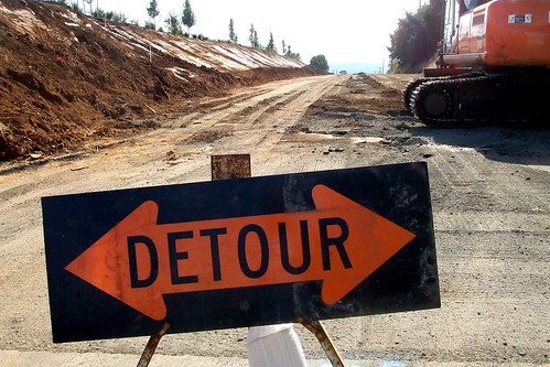
Yes, I suppose we COULD have taken the detour, but that would have been too easy. Besides, it was actually a much better surface than Don's driveway, and we were short on time. In any event, it was a very short expanse and we were soon back on smooth(ish) pavement and zooming down to the intersection with SR-22, which we would take west for about 1.5 miles before turning south onto the relatively sedate SR-51 to Independence (or "Historic Independence" as the all the directional signs reminded us). By this point Don had realized that he would never get his heart rate above 60 bpm if he stayed at our pace, so he shot off ahead. Although it had taken us a while to climb Doaks Ferry, Lynne and I had made up for much of our earlier time loss and were no longer worried about making it to the Independence control on time, so neither of us sprinted after Don. Not that we could have caught him if we tried.
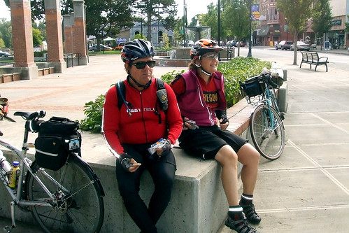
In Independence we hit up the local convenience store for lunch - yogurt and a banana for me, to augment my PB and banana sandwich (I can never have too many bananas), followed by a couple of packs of "Sharkies." I can't say the Sharkies did much for me. For true "sports food meets Gummi Bears" pleasure, I'll stick with Shot Bloks. We chatted awhile with some Salem Bike Club members out for a Sunday ride: "You know John Henry?" "Oh, yeah, let me tell you about John Henry on the 400K." In addition, Lynne and Don spent some time pondering how to pronounce the name of the market: Mootharts. "Mooth-arts? Moot-Harts? Moose Farts?"
Lunchtime over, we crossed back over the Willamette River (Crossing #3) on the bridge at Independence, and turned north toward Salem. Finally, the wind was at our backs and we moved along at a decent pace. Navigating downtown Salem on a bicycle is never much fun, but at least I know my way around. Don got ahead of me at one point, and missed a turn, but we managed to get his attention before he got too far off track. From Salem, it was back toward the Wheatland Ferry for River Crossing #4 (Ferry Crossing #3). Don left us at the turn-off to the ferry landing, having gotten in a quick 60 miles for the day. Lynne and I still had about 30 miles to go, but had managed to make up enough time that there was no longer any real fear that we would not make it back to Newberg in time.
The last 20 miles of the ride were on very familiar roads through the wine country. As we passed by the Hauer of the Dauen vineyards we noted that they had yet to harvest the grapes. Pushing the outside of the rain/frost envelope, there . . . .
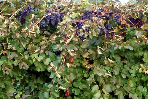
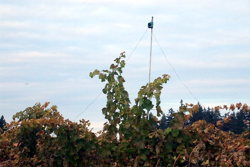
I was duly impressed by the vineyard's hi-tech scarecrows: little loudspeakers scattered throughout the vineyard broadcasting an endless loop of raptor calls and fake gunshots. At least I think they were fake gunshots.
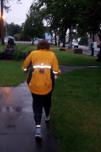
It began to get dark as we reached Dayton. We still had a dangerous stretch of highway (SR-18 and 99W) to traverse, so we stopped and donned all our reflective clothing and switched on all our lights.
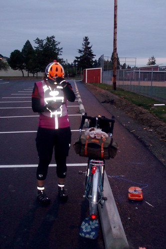
So bedecked, we set off to see how quickly we could cover the last nine miles. Lynne asked where we would regroup, because she knew I would be riding as fast as possible on the 99W because I hate being on that road any longer than necessary. But the wind was still at our backs, and Lynne was riding almost as quickly as I was, so we did not get separated after all. Lynne commented later that the stretch through Dundee seemed better paved than in the past; I thought it was just as bad as always. But my view may be colored by my loathing for that road . . .
We reached our final control shortly before 7:30 PM, finishing with more than an hour to spare, and Lynne's streak was now intact. 10 down, 2 to go . . . .
More of my pictures here
Lynne's report here