It could have snowed . . .
Monday night, November 10 - the message light on my phone is blinking. It's Lynne. "Call me," she says. She doesn't sound happy.
Ring, ring . . . "Hello?" She still doesn't sound happy.
"Hey, Lynne, what's up?"
"Have you seen the weather report? Tomorrow is supposed to be the worst day ever."
"Well, I saw one weather report that said that. But I saw another one that said that WEDNESDAY would be the worst day ever, and that tomorrow would just be, well, wet."
This mattered, you see, because the next day Lynne and I, along with our friend Bill, were scheduled to ride #11 in our series of 12 monthly 200K-plus brevets in our ongoing quest for an R-12. Yep, #11 on 11-11. Nothing like a little numerical alliteration to appeal to the OCD crowd. Not that cyclists have a higher proportion of OCD diagnoses than other groups. Yeah, right. It's a wonder any of us can finish a ride we spend so much time double-checking things.
But I digress. Back to Monday night's conversation.
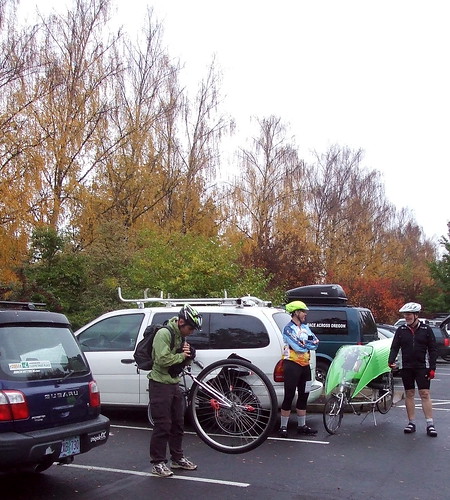
I really did not want to have to reschedule the ride, because my schedule is pretty complicated these days and it's not like the weather improves as the year gets older. I also really did not want to ride in a monsoon. So as we talked, I surfed around the Net checking the various weather pages. All the ones I looked at guaranteed rain and wind (100% chance of rain, winds of 10-20 mph) but not a LOT of rain and wind. Lynne's websites were more dire. Weather Underground didn't look so bad, though, (don't tell Sarah Palin!) and after much hemming and hawing we decided that we would at least go out to the start and decide then if the weather was too bad to go through with it. After I hung up the phone, Greg asked if we were riding - he couldn't tell which direction the conversation was going. "Oh, we're riding," I said, knowing full well that once we have our gear on we rarely turn back. More brawn than brains, sometimes.
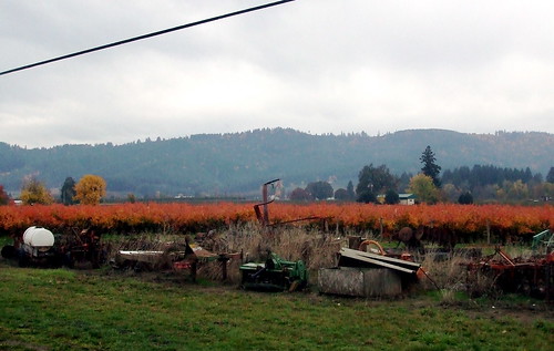
We had chosen the "Prairies and Wetlands" permanent, which starts in Newberg, about 45 minutes (by car) southwest of Portland. As Lynne pointed out, if the more dire weather reports were correct, the "wetlands" part of the route could get interesting. In order to maximize daylight, we decided to start at 6:00 AM. In theory that would mean we would have about 1 hour of darkness at each end. Of course, in theory, the day would not be overcast.
I was up at 3:30, and could hear the rain pounding on the roof. Sigh. But by 4:30 it had slacked off to a drizzle, and it's not like I haven't ridden in drizzle before. So I put the bike in the car, checked that I had all my various water-resistant layers, and headed out the door. As I drove south on the freeway, the rain stopped for a brief period but started up again shortly after I turned off on the exit to Newberg. Not too hard, though. I could still see where I was going. Sort of.
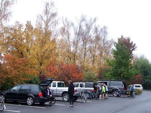
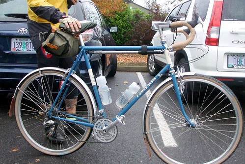
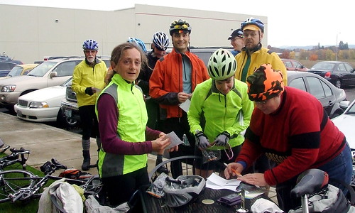
I had discovered on our last ride out of Newberg that the Thriftway there was open 24/7 and that it is has an adequate restroom (which would be more than adequate if it weren't quite so hidden away and if the stalls actually had doors on them, but it's clean and warm, which is more than I can say for many of the blue rooms I've used on rides). It also has a hot chocolate machine, fresh-baked bran muffins and friendly check-out clerks. All told, this makes for a very convenient control. So, as agreed, we met in the public parking lot by the library shortly before 6:00 AM, geared up and headed the few blocks to the Thriftway to get our first receipts and signatures on our cards.
It was dark. It was wet. It was also relatively warm. Almost too warm; we were in danger of getting as soaked from sweat as from rain. I was wearing wool S'mittens under my not-at-all waterproof rain mitts from Mountain Laurel Designs (DIGRESSIVE PSA -- DO NOT BUY THE MLD OVERMITTS - THEY ARE AWFUL) and my fingers, although damp, were toasty. I did have to wring the S'mittens out on occasion, but they never got as heavy or cold as my other winter gloves have in the past.
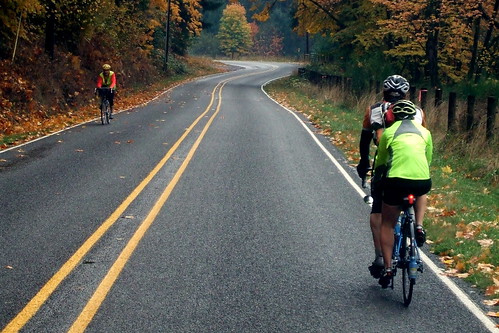
The first loop of the route was the "Prairie" part - a meandering journey through French and Howell Prairies to Mt. Angel, with a stop at the Gallon House covered bridge, followed by a more direct return across Howell Prairie to Newberg. For the first 40 miles or so we battled not only the rain but a stiff headwind. That's par for the course out on Howell Prairie (or as my friend Ray calls it "HOWL Prairie") - no matter which way you go, it's into the wind. I began to despair of ever seeing a double-digit speed again, and we reached the Mt. Angel control with very little time to spare.
In Mt. Angel we found some shelter out of the wind and rain, and ate our lunch. Bill and I had our traditional PB & J sandwiches on Dave's Killer Bread, and Lynne had something rolled up in a tortilla. She was experimenting to see if tortilla wraps were more easily chewed and digested. I never learned how that experiment turned out.
On our way back to Newberg we were disappointed to realize that the wind that had appeared to be in our face all the way out to Mt. Angel was not at our backs but, rather, more of a crosswind. But at least we were not battling it directly, and our average speed had improved from 11.4 mph to 12.1 mph by the time we reached the midpoint control (once again, the Thriftway). A diet soda, 2 small bananas and some cheap cookies from the bulk bin served as a second lunch, after which we repaired to our cars to refill our water bottles and get dry gloves.
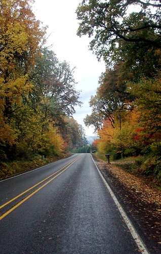
The day was winding on, and we still had 60 miles or so to go; the first six of which were on Highway 99W through Dundee, quite possibly the least-enjoyable section of road on which to cycle in the entire state of Oregon. The road surface is crap, and the traffic is terrible. Add to that the fact that a significant percentage of the drivers on that section of road have been wine "tasting" (more like wine-guzzling), and even on a good weather day it's a treacherous ride. In fact, on a good day it's even MORE treacherous, because the sun brings out more wine drinkers and drivers. Needless to say, I try to ride that stretch as quickly as possible.
We stopped in Dayton for another information control, and then rolled on through Lafayette to the longest single stretch of road on the route - 22 miles on Highway 47. The last time I rode this route, we had a significant headwind on Highway 47; this time we had a tailwind, but not much of one. Highway 47 is a very busy road, and there is not always a lot of shoulder room, but it was not nearly as bad as Highway 99W. We rolled through Carlton, Yamhill and Gaston, past many more wineries; a new one seems to pop up each week. How many bottles of pinot noir can this world accommodate? I was beginning to fantasize about the pizza parlor in Forest Grove. I was also beginning to bonk. This was surprising, because I had been eating and drinking more than usual. I think that fighting the wind and rain was taking more out of me than I had expected. If I didn't get something more substantial than an energy bar to eat soon, I was in danger of fainting. I really hoped the pizza joint would be open.
We were not quite sure where to turn off of Highway 47 to get to downtown Forest Grove, and ended up turning one street too soon. Fortunately, that road ended up connecting with the road we were supposed to be on, and soon enough we were leaning our bikes up against the sheltered window of the open (hurrah!) pizza parlor. We dripped our way in, and my glasses immediately fogged up from the warmth of the ovens. I debated getting two giant slices of pizza, but settled for one pretty big slice, a small salad, and a ginormous sugar cookie, instead. I think I took less than 5 minutes to inhale the entire meal.
We had made up some more time on the 47, and were on track to finish the ride in about 12.5 hours if we could keep the same pace, but it was getting dark and we knew we would ride more slowly in the dark. It was hard to leave the warmth (and dryth) of the restaurant, but we had less than 25 miles to go and had dry clothes waiting for us, so we pulled ourselves up, hauled on our wet gloves, and once again hit the road. The temperatures seemed to have dropped slightly, or maybe it was just because the restaurant had been so warm, but either way I was chilled. Fortunately, the next 25 miles or so involved just enough climbing to warm me back up, without being too arduous.
It was getting darker, and I could no longer see Lynne behind me, so I called out to her to switch her head light on. She had been avoiding using it because the additional drag from the generator hub would slow her down. We had a very slight wind assist, however, so switching it on was not as much of a problem as usual. I had left mine on all day, but I don't notice the drag as much, apparently.
It was raining harder now, and there was a lot of oncoming traffic. Many of the cars refused to turn their brights down for us, and so I was often riding blind. I tried staring down at the white fog line, but sometimes it would be covered in mud or leaves, and then it was hard to know where the edge of the road was. The roads we were on were all familiar from other rides, but I still was hesitant at some intersections. Fortunately, Lynne always had a good sense of where we were. Spring Hill Road seemed to go on forever, and when we finally got to our turn-off onto North Valley Road, there was so much oncoming traffic that I could not see the intersection. So I just stopped and waited for all the cars to go away before moving over for the left turn.
There is a one-lane bridge on North Valley Road, with a stop sign at each end. Vehicles are supposed to stop before crossing the bridge, but I have yet to see a car do so unless oncoming traffic is right on top of it. When we got to the bridge, I could see a car coming in the other direction. It was still quite far from the bridge, and so I started to cross over (after stopping first, of course). I was about halfway across the bridge when the car reached the stop sign on the other side and, of course, continued through - I yelled to the driver to stop and she did, but in the meantime I lost my tire grip on the slippery wooden bed of the bridge and hit the ridge in the middle -- the next thing I knew I was going down hard. I managed to unclip, and I didn't hit my head, but I smacked my elbow. Damn! That hurt!
The good thing is that my bike fell on its pannier side, so it was a little bit cushioned. I scooped myself up and hobbled over to the side. My chain was off, and the derailleur wasn't completely cooperating, but with a little help from Bill I managed to get rolling again. Everything seemed to be in working order. We continued on and very shortly thereafter were working our way through a counter intuitive series of confusing turns that would takes us from the Newberg town limits back to the parking lot where we had left our cars. I know that there has to be a more direct route from Tangen Road to the intersection of Blaine and Hancock Streets, but apparently not a shorter route, and in randonneuring it's always the shortest distance between the controls that counts. So we turned left, and then right, and then left again, and then left again, and voila, we were back to where we started. We hit the Thriftway control one more time - Lynne went through the checkout line with the same checker we'd had for our October perm, who thought we were nuts (they usually do). I, on the other hand, had a checker who did not think we were nuts at all. Of course, he told me that he runs marathons, which I think is nuts.
We'd all brought dry clothes with us, and agreed to repair to the local Burgerville to change and chow down on overpriced but tasty fast food. I monopolized the women's restroom and peeled off layer after layer of wet clothing, and checked my elbow - a small set of scrapes, but nothing to worry much about. No bruising at all (and still no bruising as I write this two days later). Warmer, drier, and more presentable, I ordered my meal and it appeared in extremely short order. I ate it in even shorter order. Sweet potato french fries . . . mmmmmm. I should not have gotten the ice cold soda, though. After drinking it, I developed a set of shakes that required an infusion of hot cocoa to cure.
11 down, one to go. Then I can relax. Until January.
Lynne's report is here
Postscript - there are no pictures because my camera finally died after being dropped from the bike one too many times. I have a new one on order . . .
And yes, I realize that I used a Dylan clip the last time I wrote about riding this route. What's frightening is that I did not realize that I had done so until I went back to read that write-up after I had already finished this one! What can I say; the man is a topical genius.
Wednesday, November 12, 2008
Sunday, November 09, 2008
Verboort Repoort
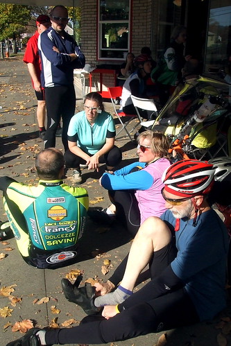
Well, the rains are upon us and the randonneuring season is beginning to wind down. On November 1, we held our penultimate ride of the year, the perennially popular Verboort populaire (try saying THAT three times fast). This ride is timed to coincide with the annual sausage and sauerkraut festival in Verboort, Oregon, a small (VERY small) town in Washington County. Despite a weather forecast that promised rain, 33 riders showed up at the ride start at the Grand Lodge in Forest Grove. Sausage always seems to draw a crowd.
I broke my rule of "ride to the ride" so that I could give my friend Beth a lift to the start. The ride started at 9:00 AM, but registration began at 8:00 and I had a sign that I needed to deliver to the organizer. So I told Beth that I'd pick her up at 7:00 AM, and she gave me directions to her house. Directions that I promptly put in a place where I could not find them when I needed them. So at 6:55 AM, I was meandering around North Portland (where the street signs are few, hidden, and poorly lit), looking for Saratoga Street. Fortunately, I have some sense of that area, and so did not take too long to find it and arrived shortly after 7:00 (although Beth later told me that her partner was worried I was not coming . . . ). We quickly loaded Beth's bike onto the rack, and then Beth directed me through the maze of streets leading to the freeway. The rain had been holding off, but it started to drizzle as we headed up and over the West Hills toward Forest Grove.
We reached the Grand Lodge just as the ride organizer was setting up shop. Other riders arrived in quick procession, and the pre-ride faffing was soon in full swing. In addition to the general ride prep, there is always the need to check out what everyone else is riding. Mike Johnson showed up with a new bike (a Rivendell model, of course), and so much time was spent inspecting it.
Then, of course, there were the unicycles . . .
We also spent an inordinate amount of time trying to figure out what to wear. The drizzle had stopped, but the sky looked pretty grey. It was also warm, however, which meant that dressing for rain could result in overheating if the rain held off. I decided to ditch the leg warmers, but put on rain booties over my winter riding shoes. On top I had a long-sleeve wool jersey over a thin wool camisole and, of course, my Showers Pass rain jacket.
Thus clad, I was ready to roll. We still had a few minutes before the official start, however, so I trotted on over to the hotel to score a cup of hot tea from the hospitality room (I figure I spend enough money there over the year that one cup of tea is okay) and to make one last use of the public facilities . . .
And then we were off. Full disclosure requires explaining that Verboort and Forest Grove are right next to each other, and the site of the festival is less than 2 miles from the Grand Lodge. But this was a 100K populaire. That meant that we had to find another 60 miles somewhere. We did so by riding first to Hillsboro, then to Snooseville, from Snooseville to Banks and then back to Verboort by way of Cedar Canyon.
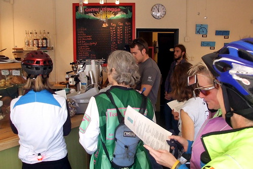
The first control, then, was in Hillsboro, at Longbottom Coffee Roasters, which also happens to be where Portland Velo begins its Saturday rides. Because this first control was only about 12 miles into the route, most of the riders were still fairly close together in time and so we descended en masse, creating a little bit of a kerfuffle for the control worker.
I had hoped to get a scone or muffin, because my oatmeal breakfast would soon wear off, but the line at the cash register was too long and I was on a mission to finish the ride in less than 4.5 hours. I figured that there might be snacks at the Snooseville control, as there had in years past, so saddled up and rode on.
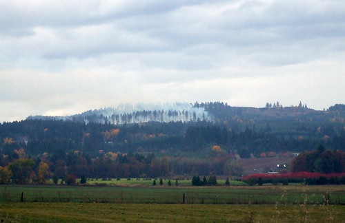
To get to Snooseville, we backtracked for a couple miles on Evergreen Parkway and then turned north, toward the town of North Plains. The route took us past farms, fields, and groves of trees in full fall foliage display. In the hills I could see smoke from a fire - it was raining at this point but apparently not hard enough to put out the flames - I was able to watch it spread as we rode along.
Just before we reached North Plains, I reached down for my water bottle and grabbed air. Whoops. Even with all that time at the start, I had managed to leave the bottle in my car. Fortunately, there is nice market in North Plains where I stopped and bought a bottle of water that would fit in the cage. I took the opportunity to powder my nose, as well. The group I had been riding with went on without me, but I knew I'd catch up to them at the next control.
Snooseville is at the end of a long, deceptive climb up Dairy Creek Road. The road LOOKS flat, but has a slight grade. The first time I rode on it, I could not figure out why my speed had dropped precipitously. I quickly figured it out when I turned around at end of the road, and sailed back down. I have since ridden on DCR many times, but the grade still surprises me.
I reached the Snooseville control to discover that there was water to be had, but no snacks. Bummer. At this point we had less than 30 miles to go, however, and I was not feeling any hunger pangs. I figured I'd just ride faster, get done sooner, and get some cookies on the way home (I doubted that there would be any soy sausage at the festival).
The Snooseville section of the route is an "out and back," so on the way to the next control I passed a number of riders who were taking the course more slowly (just as I had been passed by those riders who were taking the course more swiftly).
From Snooseville we rode on to Banks, which required us to cross Highway 26 at Frogger Junction, as my friend Jason so aptly calls the intersection. On this day, however, traffic on the highway was light and we made it across without any wait. In Banks, we turned onto Cedar Canyon Road, which is one of my favorite cycling roads. It has a bit of a climb, followed by a long, smooth descent, and passes a beautiful wetland and fields that, in the spring, are covered in crimson clover. This time of year, the clover is gone, but the leaves on the trees are fluorescent. The wetland was very wet - I could see a number of geese, ducks, and at least one heron hanging out enjoying waterfowl weather.
One more info control (a couple of throughly bedraggled yellow pom-poms left over from February's Snooseville Populaire (which followed pretty much the same route), and then it was onto the final 10-mile leg. We had one more hill to climb, at which point I dropped my fellow riders, and then a mostly flat section. Of course, that mostly flat section ended up being directly into the wind. Dang. But it wasn't raining, the scenery was lovely, and I was enjoying myself, so for once I did not mind the wind. I just geared down and poodled along, admiring the blazing blueberry bushes along the way.
Just outside Verboort, the traffic got heavy, but there were plenty of people in Hi-Vis yellow vests making the trucks and SUVs slow down, and I was able to work my way around without too much hassle. I located the final control and checked in. Four hours, nineteen minutes. Not bad. Not bad at all.
There is only one more "official" ride of the season, the Wine Country populaire on November 22, but I will still be riding brevets in my quest for an R-12, so my season is not ending - just getting a little less intense . . . .
More pictures here
Beth's report here
Bill Alsup's report here
I broke my rule of "ride to the ride" so that I could give my friend Beth a lift to the start. The ride started at 9:00 AM, but registration began at 8:00 and I had a sign that I needed to deliver to the organizer. So I told Beth that I'd pick her up at 7:00 AM, and she gave me directions to her house. Directions that I promptly put in a place where I could not find them when I needed them. So at 6:55 AM, I was meandering around North Portland (where the street signs are few, hidden, and poorly lit), looking for Saratoga Street. Fortunately, I have some sense of that area, and so did not take too long to find it and arrived shortly after 7:00 (although Beth later told me that her partner was worried I was not coming . . . ). We quickly loaded Beth's bike onto the rack, and then Beth directed me through the maze of streets leading to the freeway. The rain had been holding off, but it started to drizzle as we headed up and over the West Hills toward Forest Grove.
We reached the Grand Lodge just as the ride organizer was setting up shop. Other riders arrived in quick procession, and the pre-ride faffing was soon in full swing. In addition to the general ride prep, there is always the need to check out what everyone else is riding. Mike Johnson showed up with a new bike (a Rivendell model, of course), and so much time was spent inspecting it.
Then, of course, there were the unicycles . . .
We also spent an inordinate amount of time trying to figure out what to wear. The drizzle had stopped, but the sky looked pretty grey. It was also warm, however, which meant that dressing for rain could result in overheating if the rain held off. I decided to ditch the leg warmers, but put on rain booties over my winter riding shoes. On top I had a long-sleeve wool jersey over a thin wool camisole and, of course, my Showers Pass rain jacket.
Thus clad, I was ready to roll. We still had a few minutes before the official start, however, so I trotted on over to the hotel to score a cup of hot tea from the hospitality room (I figure I spend enough money there over the year that one cup of tea is okay) and to make one last use of the public facilities . . .
And then we were off. Full disclosure requires explaining that Verboort and Forest Grove are right next to each other, and the site of the festival is less than 2 miles from the Grand Lodge. But this was a 100K populaire. That meant that we had to find another 60 miles somewhere. We did so by riding first to Hillsboro, then to Snooseville, from Snooseville to Banks and then back to Verboort by way of Cedar Canyon.
The first control, then, was in Hillsboro, at Longbottom Coffee Roasters, which also happens to be where Portland Velo begins its Saturday rides. Because this first control was only about 12 miles into the route, most of the riders were still fairly close together in time and so we descended en masse, creating a little bit of a kerfuffle for the control worker.
I had hoped to get a scone or muffin, because my oatmeal breakfast would soon wear off, but the line at the cash register was too long and I was on a mission to finish the ride in less than 4.5 hours. I figured that there might be snacks at the Snooseville control, as there had in years past, so saddled up and rode on.
To get to Snooseville, we backtracked for a couple miles on Evergreen Parkway and then turned north, toward the town of North Plains. The route took us past farms, fields, and groves of trees in full fall foliage display. In the hills I could see smoke from a fire - it was raining at this point but apparently not hard enough to put out the flames - I was able to watch it spread as we rode along.
Just before we reached North Plains, I reached down for my water bottle and grabbed air. Whoops. Even with all that time at the start, I had managed to leave the bottle in my car. Fortunately, there is nice market in North Plains where I stopped and bought a bottle of water that would fit in the cage. I took the opportunity to powder my nose, as well. The group I had been riding with went on without me, but I knew I'd catch up to them at the next control.
Snooseville is at the end of a long, deceptive climb up Dairy Creek Road. The road LOOKS flat, but has a slight grade. The first time I rode on it, I could not figure out why my speed had dropped precipitously. I quickly figured it out when I turned around at end of the road, and sailed back down. I have since ridden on DCR many times, but the grade still surprises me.
I reached the Snooseville control to discover that there was water to be had, but no snacks. Bummer. At this point we had less than 30 miles to go, however, and I was not feeling any hunger pangs. I figured I'd just ride faster, get done sooner, and get some cookies on the way home (I doubted that there would be any soy sausage at the festival).
The Snooseville section of the route is an "out and back," so on the way to the next control I passed a number of riders who were taking the course more slowly (just as I had been passed by those riders who were taking the course more swiftly).
From Snooseville we rode on to Banks, which required us to cross Highway 26 at Frogger Junction, as my friend Jason so aptly calls the intersection. On this day, however, traffic on the highway was light and we made it across without any wait. In Banks, we turned onto Cedar Canyon Road, which is one of my favorite cycling roads. It has a bit of a climb, followed by a long, smooth descent, and passes a beautiful wetland and fields that, in the spring, are covered in crimson clover. This time of year, the clover is gone, but the leaves on the trees are fluorescent. The wetland was very wet - I could see a number of geese, ducks, and at least one heron hanging out enjoying waterfowl weather.
One more info control (a couple of throughly bedraggled yellow pom-poms left over from February's Snooseville Populaire (which followed pretty much the same route), and then it was onto the final 10-mile leg. We had one more hill to climb, at which point I dropped my fellow riders, and then a mostly flat section. Of course, that mostly flat section ended up being directly into the wind. Dang. But it wasn't raining, the scenery was lovely, and I was enjoying myself, so for once I did not mind the wind. I just geared down and poodled along, admiring the blazing blueberry bushes along the way.
Just outside Verboort, the traffic got heavy, but there were plenty of people in Hi-Vis yellow vests making the trucks and SUVs slow down, and I was able to work my way around without too much hassle. I located the final control and checked in. Four hours, nineteen minutes. Not bad. Not bad at all.
There is only one more "official" ride of the season, the Wine Country populaire on November 22, but I will still be riding brevets in my quest for an R-12, so my season is not ending - just getting a little less intense . . . .
More pictures here
Beth's report here
Bill Alsup's report here
Saturday, November 01, 2008
Le Tour des Boulangeries Avec L'Equipe Bag Balm
I confess, I have been dilatory in my blog postings. I decided that I really did need to spend some time on something other than my bike saddle and computer chair. So instead of blogging last weekend's ride while it was fresh, I spent time cleaning out the raised beds and planting the winter crops, cleaning my house and doing laundry. Oh, and spending time with Greg, who was wondering what I looked like these days. . .
But Greg is out of town this weekend, it is raining too hard to garden, the laundry is done, and so, without further ado, it's time to play catch up.

It had been a while since more than three members of Team Bag Balm had managed to get together to ride - more than four months, in fact. The last time we'd gotten a herdlet together was late June. So when Richard suggested another bakery ride, the response was immediate and enthusiastic. After some calendar viewing, it was decided that we'd ride on Sunday, October 26 - rain or shine, but we hoped for shine.
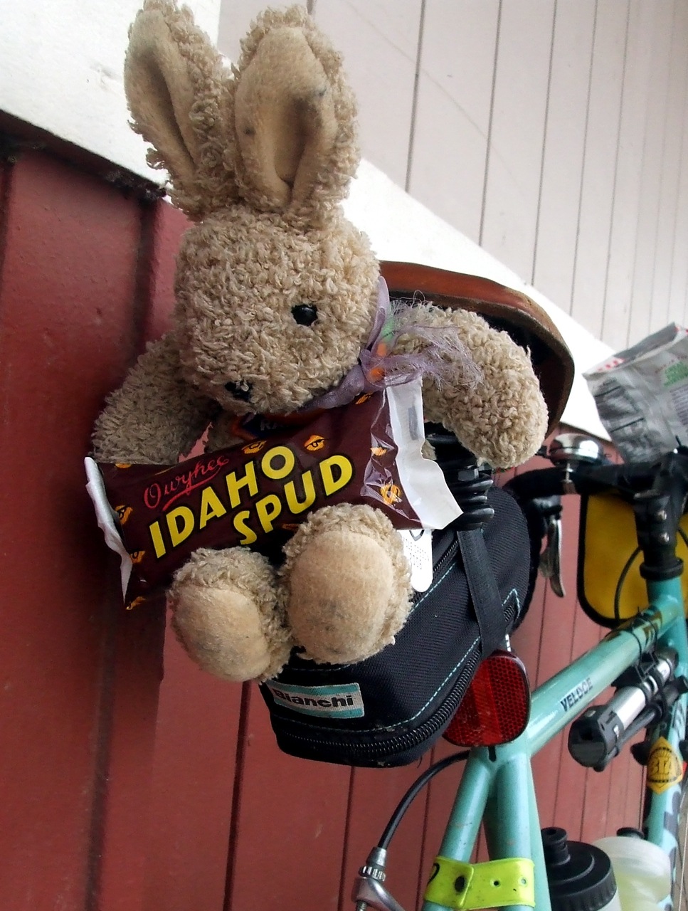
Sunday dawned bright, warm, and a little bit windy. I decided to ride the Bianchi and took nothing more than a tiny tool bag. After so many thousands of miles on the fully-loaded Sweetpea, I felt like a dancer who had shed her lead shoes. As a result, I wildly overestimated how long it would take me to get to St. Cupcake in NW Portland, our agreed-upon starting point. The idea was that we would meet there when it opened at 10 AM, scarf down some cupcakes and head off in search of more baked goods in other parts of town. I got there at 9:40, and spent the next 20 minutes riding "laps" from NW 18th and Everett to Thurman, and back on NW 19th. By the time 10:00 rolled around, I was ready for a cupcake!
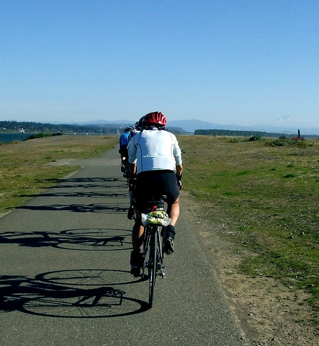
The glorious weather brought out a record number of riders, some of whom I hadn't ridden with in years. We ate cupcakes, gathered for a group photo, and set off. Our next scheduled stop was Pastry Cat in the St. Johns neighborhood in the north end of the city on the east side of the river. About half of us took a route that involved a foray into the west hills and back down to the St. Johns Bridge by way of Cornell, Thompson, Skyline and Germantown Road. The other half opted for a flatter, faster, route straight down Highway 30 to the bridge.

I was in the "hill" group, of course. As we headed up, I noticed that it seemed awfully easy. I then noticed that leaves were coming off the trees in prodigious quantities. Tailwind! The result was one of the easiest climbs to Skyline I've done in ages. The falling leaves made the ride almost magical, as they fluttered and swirled around us. Because I was having such an easy time of the climb, I decided to take a short detour from Cornell onto 53rd Street, which would eventually connect back to Thompson but would give me some extra climbing in the interim so as to justify more pastries.
When I popped back out on Thompson, I met up with Nora, and shortly thereafter we met up with the rest of the climbers at the intersection with Skyline. We then cruised north on Skyline, with the wind still assisting us, to Germantown Road, where we again regrouped before a swift, sharp and technical descent to the bridge.

While we were waiting at the top of the hill, we got a call from one of the riders who had opted for the flat route; Pastrycat was closed, and so they would meet us at the Little Red Bike Cafe. I had heard of the LRB, but had not yet been there, so I was not too upset about missing out on Pastrycat.
So it was over the river, and through the strip malls, to the LRB we went. When we arrived, we saw that we were not the only cyclists out enjoying the day and seeking tasty food. Fortunately, the LRB staff are quite efficient. Table space was at a premium, though.
From St. Johns, we took the Peninsula Crossing Trail to Marine Drive, and turned east toward the I-205 Bike Path. We also turned into the wind. Ouch. And here I had been worried that I wouldn't be working off the giant bagel I'd chosen for lunch. We quickly realized that the only way to survive would be to paceline; somehow Richard and Nancy got conned into pulling the line with their tandem the entire way. Even with a line, it was a tough go. Cyclists heading the other direction were using their jackets - I hated them.
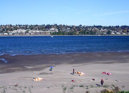
The wind was so strong that even the kite boarders gave up.
We finally made it to the end of the Marine Drive path, and turned south onto the I-205 path. The wind was no longer a factor, and we were able to maintain a normal pace. At this point there were 17 of us, spread out over about a mile. The plan was to take the path to SE Division, and then head west on Division to our next bakery stop - Petit Provence, at SE 48th and Division. But you know what they say about plans - the best laid ones aft gang agley.
Our plan ganged agley just east of the intersection of SE Division and 87th, when a careless, thoughtless, brainless driver "right hooked" Richard and Nancy. Because they were the last riders in our line, none of us saw it happen; another driver flagged us down to tell us to turn back. We turned around and blasted back down the sidewalk (no time to cross over to the street path) to the scene. When we arrived, we found Nancy lying on the ground and Richard up and walking, but in shock. The driver and her passenger were still there, as were witnesses who saw the whole thing. Susan O. took charge, calling 911 and making sure that everyone stayed at the scene. Soon we were joined by an ambulance, a fire truck, and two patrol cars.

The EMTs talked with Nancy for a while, took her blood pressure, and decided she should go to the hospital, just as a precaution. Richard would go with her, and their tandem would go home in a friend's truck. The rest of us would continue on to the bakery to catch those riders who had been so far ahead that they missed the excitement (we'd called them to let them know what had happened). We were all quite sad that the ride had taken such a bad turn, but were happy that Richard and Nancy weren't more badly hurt. We would learn later that Richard had a fractured finger, and they were both bruised and sore, but we all agreed it could have been so much worse. None of us could understand how the driver could not have seen the large, bright-red tandem and its even more brightly-clad riders. Another instance of willful blindness to cyclists, no doubt. At least she had insurance!
On the bright side, before the incident, we had managed to get in 40 miles of great riding in glorious weather with good friends.
More photos here
But Greg is out of town this weekend, it is raining too hard to garden, the laundry is done, and so, without further ado, it's time to play catch up.
It had been a while since more than three members of Team Bag Balm had managed to get together to ride - more than four months, in fact. The last time we'd gotten a herdlet together was late June. So when Richard suggested another bakery ride, the response was immediate and enthusiastic. After some calendar viewing, it was decided that we'd ride on Sunday, October 26 - rain or shine, but we hoped for shine.
Sunday dawned bright, warm, and a little bit windy. I decided to ride the Bianchi and took nothing more than a tiny tool bag. After so many thousands of miles on the fully-loaded Sweetpea, I felt like a dancer who had shed her lead shoes. As a result, I wildly overestimated how long it would take me to get to St. Cupcake in NW Portland, our agreed-upon starting point. The idea was that we would meet there when it opened at 10 AM, scarf down some cupcakes and head off in search of more baked goods in other parts of town. I got there at 9:40, and spent the next 20 minutes riding "laps" from NW 18th and Everett to Thurman, and back on NW 19th. By the time 10:00 rolled around, I was ready for a cupcake!
The glorious weather brought out a record number of riders, some of whom I hadn't ridden with in years. We ate cupcakes, gathered for a group photo, and set off. Our next scheduled stop was Pastry Cat in the St. Johns neighborhood in the north end of the city on the east side of the river. About half of us took a route that involved a foray into the west hills and back down to the St. Johns Bridge by way of Cornell, Thompson, Skyline and Germantown Road. The other half opted for a flatter, faster, route straight down Highway 30 to the bridge.
I was in the "hill" group, of course. As we headed up, I noticed that it seemed awfully easy. I then noticed that leaves were coming off the trees in prodigious quantities. Tailwind! The result was one of the easiest climbs to Skyline I've done in ages. The falling leaves made the ride almost magical, as they fluttered and swirled around us. Because I was having such an easy time of the climb, I decided to take a short detour from Cornell onto 53rd Street, which would eventually connect back to Thompson but would give me some extra climbing in the interim so as to justify more pastries.
When I popped back out on Thompson, I met up with Nora, and shortly thereafter we met up with the rest of the climbers at the intersection with Skyline. We then cruised north on Skyline, with the wind still assisting us, to Germantown Road, where we again regrouped before a swift, sharp and technical descent to the bridge.
While we were waiting at the top of the hill, we got a call from one of the riders who had opted for the flat route; Pastrycat was closed, and so they would meet us at the Little Red Bike Cafe. I had heard of the LRB, but had not yet been there, so I was not too upset about missing out on Pastrycat.
So it was over the river, and through the strip malls, to the LRB we went. When we arrived, we saw that we were not the only cyclists out enjoying the day and seeking tasty food. Fortunately, the LRB staff are quite efficient. Table space was at a premium, though.
From St. Johns, we took the Peninsula Crossing Trail to Marine Drive, and turned east toward the I-205 Bike Path. We also turned into the wind. Ouch. And here I had been worried that I wouldn't be working off the giant bagel I'd chosen for lunch. We quickly realized that the only way to survive would be to paceline; somehow Richard and Nancy got conned into pulling the line with their tandem the entire way. Even with a line, it was a tough go. Cyclists heading the other direction were using their jackets - I hated them.
The wind was so strong that even the kite boarders gave up.
We finally made it to the end of the Marine Drive path, and turned south onto the I-205 path. The wind was no longer a factor, and we were able to maintain a normal pace. At this point there were 17 of us, spread out over about a mile. The plan was to take the path to SE Division, and then head west on Division to our next bakery stop - Petit Provence, at SE 48th and Division. But you know what they say about plans - the best laid ones aft gang agley.
Our plan ganged agley just east of the intersection of SE Division and 87th, when a careless, thoughtless, brainless driver "right hooked" Richard and Nancy. Because they were the last riders in our line, none of us saw it happen; another driver flagged us down to tell us to turn back. We turned around and blasted back down the sidewalk (no time to cross over to the street path) to the scene. When we arrived, we found Nancy lying on the ground and Richard up and walking, but in shock. The driver and her passenger were still there, as were witnesses who saw the whole thing. Susan O. took charge, calling 911 and making sure that everyone stayed at the scene. Soon we were joined by an ambulance, a fire truck, and two patrol cars.
The EMTs talked with Nancy for a while, took her blood pressure, and decided she should go to the hospital, just as a precaution. Richard would go with her, and their tandem would go home in a friend's truck. The rest of us would continue on to the bakery to catch those riders who had been so far ahead that they missed the excitement (we'd called them to let them know what had happened). We were all quite sad that the ride had taken such a bad turn, but were happy that Richard and Nancy weren't more badly hurt. We would learn later that Richard had a fractured finger, and they were both bruised and sore, but we all agreed it could have been so much worse. None of us could understand how the driver could not have seen the large, bright-red tandem and its even more brightly-clad riders. Another instance of willful blindness to cyclists, no doubt. At least she had insurance!
On the bright side, before the incident, we had managed to get in 40 miles of great riding in glorious weather with good friends.
More photos here
Subscribe to:
Posts (Atom)