On December 6, 2008, I completed an RUSA R-12. It was quite an accomplishment, if I say so myself. Not many people have done it, although judging by the number of people I know personally who have done it, the list is growing exponentially. Nothing like the challenge of riding at least one randonnée of at least 200 km in length every month for 12 consecutive months to get those OCD gears implanted in most randonneurs' brains grinding.
Some people--saner people, people with lives outside of cycling, people who are properly medicated--okay, MOST people, would chalk up the feat, check it off their list, and move on to healthier pursuits. I don't know any of those people. I know randonneurs. And the randonneurs I know all gathered in a parking lot in Newberg, Oregon at 6:30 AM on a January morning with temperatures hovering just above freezing to embark on R-12 Year 2, or R-24. Our friend Sal, who completed an R-24 the day I completed my R-12, declined to join us. He knew that if he rode in January he would feel compelled to go for an R-36 and that's just too sick.
The weather forecast earlier in the week had been iffy, at best. The chance of rain hovered between 30 and 60%, and there were some mutterings about more snow. But by Friday, the forecast had improved--Saturday would be overcast, with a slight chance of rain late in the evening. Ever pessimistic, I packed a bag full of rain gear nonetheless. I figured if nothing else I could leave it in the car and pick it up for the second loop of the route if I needed it.
My friend Michael wanted to join us. He does not have a car, so I told him I could drive him to the start. He typically finishes a brevet at least 4 hours ahead of me, so he planned to ride home from Newberg afterward. It's not a bad ride from Newberg to Portland, he just didn't want to have to add it on to both ends of the brevet. In addition to Michael, our group at the start included our usual R-12 gang: Lynne, Bill, the Kramer, Vincent, John Henry and Joanne. Our friends Sandy, Elsie, David, and Kevin also joined us, but not as officially registered riders. That meant that they could not help us with flats or mechanicals. They pointed out that we could still help them, however. Yeah, right.
Michael and I arrived very early. One symptom of my particular obsessiveness is a pronounced fear of being late; as a result I am ALWAYS early and spend a lot of time messing around before the start. Amazingly, even with all that extra time, I inevitably forget to do something before starting (resetting cyclometer, turning on GPS tracker, etc). Sigh.
We had chosen the Prairies and Wetlands route, a Figure 8 that starts and ends in Newberg. The first loop goes southeast to the town of Mt. Angel and back, and the second loop goes northwest to Forest Grove and back. The first loop is ever so slightly longer than the second, but the second loop contains two endless stretches of road that makes it SEEM longer. One of those stretches is a 22-mile grind on State Highway 47. Not my favorite stretch of road. Not as bad as Highway 99 between Newberg and Dundee (the most loathsome road ever), but still pretty bad. The last time I did this route was under less than optimal conditions. I was looking forward to a better day this time around.
We started at 7 AM from the Thriftway. They have come to know us well there. They have the "Here's your receipt, where do I sign your card" drill down pat. We were all riding together at first, but Michael quickly sped off the front. I was riding along with David when suddenly his front bag decided to jump ship. Literally. It flew off the front of his bike and landed upside-down in the road. I stopped to help him pick it up, and the rest of the group passed us by. I caught up with them all again before we crossed the Willamette, however. I passed Lynne just before the bridge, and that was the last I saw of her for the day. I caught up with Bill after the bridge, and rode with him for a few miles before he dropped back, and then I did not see him for the rest of the day either. I spent most of the ride with John Henry, Joanne, Kevin, Sandy and Elsie. They were all pushing pretty hard, and there were many times when I was struggling to keep up, but I managed to do well enough to at least catch up with them at all the contrôles.
The morning ride was uneventful and we reached the first loop's turnaround at Mt. Angel in less than 3 hours. Kevin and David were in and out of the contrôle in mere minutes, but the rest of us spent a little extra time eating and drinking before moving on. On the way back, I was beginning to fall off the end of our small (now smaller) group, but they took some time to stop in Gervais to look at Elsie's new landscaping and I took the opportunity to get ahead enough that I could relax until they caught up with me again. Which they did, on Butteville Road, just outside of Donald. Shortly thereafter, we caught up with Kevin. He had stopped for a snack and David had kept going. We did not see David for the rest of the ride.
Back in Newberg, we stopped at the Coffee Cottage for lunch. On a timed ride, it is generally not a good idea to put yourself at the mercy of a "sit-down" restaurant, but we had a pretty good time cushion going for us. The remarkably slow service at the CC chewed away much of that cushion, however. Joanne left a little after the rest of us, and as she was leaving she saw Lynne and "a gang" pulling into town. So we figured they would be about half an hour behind us.
Then it was back to the parking lot to refresh our supplies and making clothing adjustments for Loop #2. That loop begins with the dreaded Newberg-Dundee section of Highway 99W. This time around the road was even more loathsome, because the shoulders were filled with gravel and debris from the late-December snow storms. And there was a LOT of traffic. ON the way into Dundee, I rode over the scale at the ODOT Weigh Station. 200 pounds! I am guessing the scale was a wee bit off, because after subtracting for my weight (fully clothed), that still left at least 60 pounds of bike and gear. My bike is very heavy, but I don't think it is THAT heavy. But it does give me a good excuse for why I was having trouble keeping up with the others in my group. In Dundee I had my only close call of the day, when I was almost right hooked by a driver who forgot we were there as soon as he passed us. Bad driver. Bad, bad driver. After another mile or so of hell, we were finally through Dundee and it was on to Dayton and Lafayette before hooking onto Highway 47 for what seemed like an eternity. The shoulders on 47 range from wide to non-existent, but like those on the 99, this time around they were filled with debris, forcing us to ride on the highway at times.
By this point, I had given up all hope of staying with the faster riders. All but Kevin pulled ahead and disappeared in the distance. Kevin hung back with me because, as he put it, "Two of us are more visible than one, and I don't like riding this road alone." I appreciated that, especially because it meant that he had to drop his speed at least 3 miles an hour to do it.
We reached Forest Grove just before 3 PM. Maggie's Buns was still open and we ran in for some sustenance. After some more remarkably slow service (but remarkably good macaroni and cheese), it was time to take on the last 25 miles back to Newberg. I was excited to be riding this section in daylight hours. By my calculations, even at the slower pace I had settled to, I could get to Newberg without having to put on my reflective gear or turn on my headlights! I told the others to go on ahead and not worry. I knew this stretch of road by heart, and was content to ride alone. They did not argue. Like horses who could sense the barn, they clearly were in the mood to set a record for the return. I was not planning on being a slug, but I could afford to just poodle along at this point. So poodle I did.
A few miles in, I came across Kevin by the side of the road. He had stopped for a snack. I kept on going, assuming he would catch up with me (and pass me) soon enough. He never did. I started to worry that something had happened to him, but didn't worry enough to turn around and look for him. As it turns out, he was okay, he had just gotten a little too bonky to catch up.
I reached Newberg at about 5:15, but took a little detour through the unpaved section of town and added some time onto my finish. Okay, I took a wrong turn. You'd think by now I would know what that stupid "240 turns into Main, turn left on Main" cue really means. I stopped at an ATM to get a time-stamp (5:22 PM), loaded the bike on the car and went over to the Coffee Cottage where the rest of "my" group had gathered. Turns out they were only about 15 minutes ahead of me. I got a soy cocoa (tepid) and a biscotti (tasteless) and headed for home, a hot bath and piles of leftover sizzling eggplant and tofu.
Time to start planning February's ride. Or perhaps it's just time to take some more pills.
Oh, and there are no pictures because I did not see anything that warranted pulling out the camera. Perhaps a sign that I have become bored with a route, Or perhaps just a little less obsessive about one aspect of my rides. Yeah, right.
Sunday, January 25, 2009
Saturday, January 10, 2009
Too Much Information Smackdown
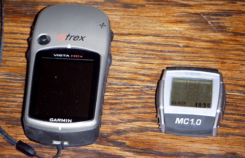
This year's present from the Solstice Bear was a Garmin eTrex Vista GPS unit. It will take me months to master all its features, but today I took it for a basic tracking test run on my club ride. I had my VDO cyclometer, as well, so I could to a side-by-side comparison. Well, not exactly side-by-side--the VDO was mounted in its usual place on the handlebar and the GPS was in my front bag. But I digress.
For a basic cyclometer, the VDO provides a wealth of information. Too much information, some of my friends would say, given my post-acquisition habit of calling out the grade of whatever monster hill we were climbing. Did we REALLY need to know that Cole School Rd is 18%? (That's a rhetorical question--of COURSE we needed to know that. How else could we later brag about conquering it?). But because its data output is based on things like how well I measured my wheel size and how accurately I calculated my starting altitude, I was never quite positive that it was giving me the right information. Plus, it was no use to me if I got lost and needed a map. Enter the Garmin.
I purposely did not get a bicycle-specific Garmin. One, they are very expensive. Two, they have really poor battery life. Three, they are no good on a snowshoeing expedition (ditto there for the VDO). Several of my friends use the eTrex Vista and on their recommendation, that's what I went for. It was far less expensive and has a far longer battery life. Plus, I can plug in a topo card and hit the trail(s).
So how do the two compare? Well, as far the basic stats go, there was not much of a difference.
VDO:
Mileage 78.71
Max Speed 34
Average Speed 13.7
Elevation Gain 3841' (measured by barometric pressure)
Max Elevation 1215'
Garmin:
Mileage 77.9
Max Speed 34.1
Average Speed 13.6
Elevation Gain 3952' (measured by satellite)
Max Elevation 1173'
The VDO was able to tell me the temperature (31 degrees when I left home at 7:30 AM, 36 degrees when I returned home at 3:00 PM), which the Garmin could not. Unlike the Garmin, however, the VDO could not direct me to the nearest restaurant, bowling alley or geocache.
More importantly, the VDO could not let me come home and do this
Thursday, January 01, 2009
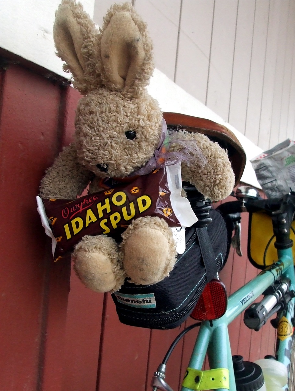
Ain't He Handsome in His New Duds?

Better Than a Showers Pass Jacket!
Originally uploaded by cecilanne
It's nice to have talented friends. Lynne knew that TRFKAF had pretty much given up on that teeny, tiny Showers Pass jacket he had his little stuffed heart set on, so she knitted him a most stunning sweater in colors to match my bike.
Subscribe to:
Posts (Atom)